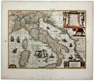
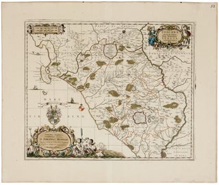
Dominio Fiorentino.
A scarce, richly engraved map of northern Tuscany from the first Italian national atlas. Florence is in the center of the map; Lucca and Pisa are to west; and Siena and Arrezzo are also included. More
One of the most richly decorative, early maps of Italy in vibrant color of the period. The map’s title, in Italian, is flanked by two caryatid-like women. Below the cartouche, the legendary founders of Rome, Romulus and Remus, are nursed by their adoptive wolf mother. The sea is embellished with..... More
A remarkably detailed and beautiful plan of Florence and its immediate surroundings, including Fiesole. No fewer than 228 structures are listed and keyed to the plan. In a refreshing departure from the usual subjects that ordinarily flank early maps, this work offers several scenes of cultural events, most being athletic..... More
A richly decorative map, in a superb example, of the northern Latium region of Italy, depicting the area from Rome in the south to Orvieto in the north, and delimited by the Tiber River in the east. It appears that the map was never a regular component of the Jansson..... More
A striking city plan of Rome by the Augsburg cartographer/publisher Matthäus Seutter (1678-1757), here in a vibrant original hand-color example. The map is based on Giovanni Battista Falda’s (1643-78) important 1667 two-sheet plan of Rome, known as his pianta piccola, which was “an instant success” and quickly became “one of..... More
A striking city plan of Naples with vibrant original color. There are also seven large vignettes; illustrated in those along the top are the primary landmarks of Naples’ great seaport – the Castel dell’ Ovo, the Molo, and the Castel Nuovo. Along the bottom, the Piazza del Mercato is pictured..... More
Bertelli’s Italia Novamente posta in Luce, one of the rarest and most attractive La Freri maps of Italy. Borri reports that only a few examples of this finely engraved map have surfaced: “Di questa magnifica carta, quasi sconosciuta sino a pochi anni orsono, sono noti pochissimi esemplari …” He further..... More
Rare separately published first edition of this 1665 ichnographic plan of Rome, in full contemporary handcolor, designed by the Ghent architect, draftsman, and etcher Lievin Cruyl (1634-c. 1720). Famous for his remarkably executed vedute of Rome, drawn with the aide of optical instruments to spectacular effect, and the present plan..... More
A very attractive large bird’s eye-view of Venice derived from Merian’s 1638 version, updated with the new addition of the Basilica della Salute, which was completed only in 1687. The view is “considered one of the most beautiful and appreciated Venetian maps” (Moretto, 114), and is set within a laurel..... More
Rare. A resplendent map in a bright, richly colored example. One of the most elaborate works of early mapmaking, it contains 38 insets of the major ports and cities of the Mediterranean. It was the centerpiece of the monumental atlas, the Neptune François: “the most expensive sea-atlas ever published in..... More
A superb, contemporary-bound, complete copy of a rare Italian atlas, nearly always found incomplete, and important for incorporating the new geo-political contours of Europe decided upon at the Congress of Vienna held at the end of the Napoleonic Wars. The library of the Senato della Repubblica only acquired a copy..... More