Veteris et Modernae Urbis Romae Ichnographia.
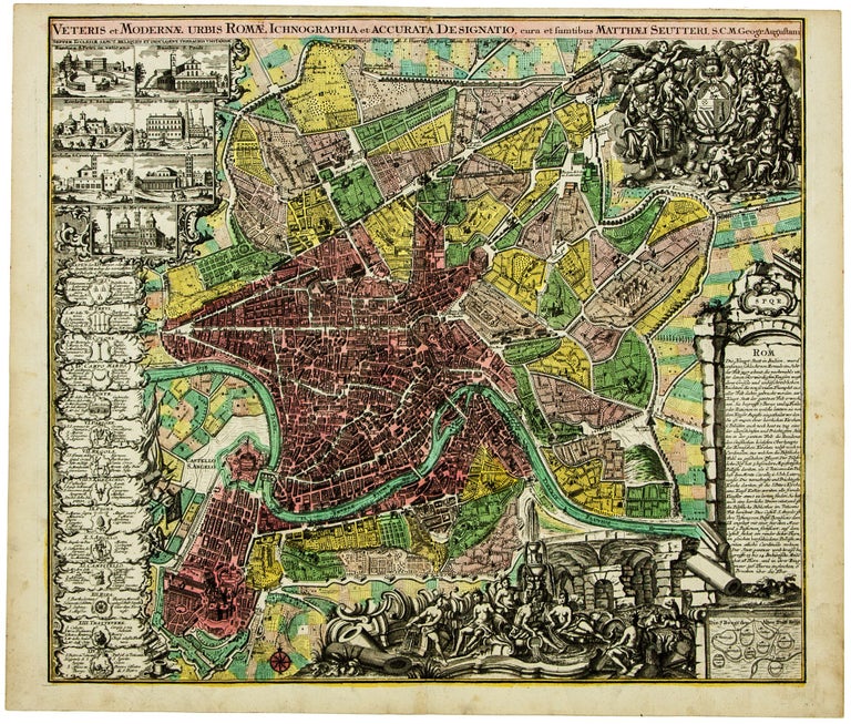
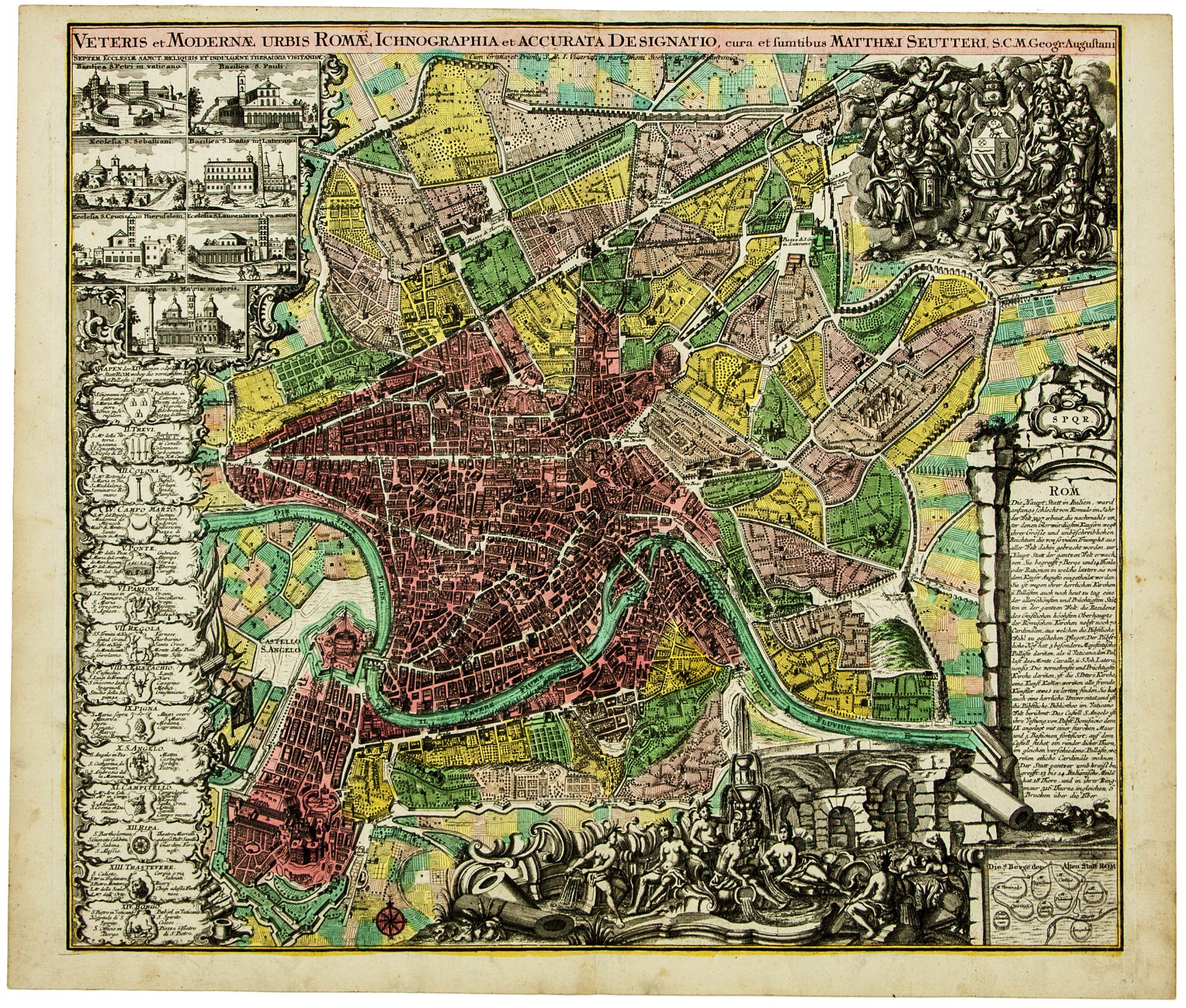
Folio [49.9 x 58.4 cm] single-sheet etching in original hand-color. Colors still fresh and vibrant, vertical centerfold, minor marginal staining. A striking city plan of Rome by the Augsburg cartographer/publisher Matthäus Seutter (1678-1757), here in a vibrant original hand-color example. The map is based on Giovanni Battista Falda’s (1643-78) important 1667 two-sheet plan of Rome, known as his pianta piccola, which was “an instant success” and quickly became “one of the most frequently and enduringly copied maps of the early modern period” (Maier, p. 196), proliferating in versions across Europe. Seutter’s etching remains faithful to Falda’s delineation of baroque Rome, which celebrated the urban interventions of Pope Alexander VII (r. 1655-77). Seutter, however, dispenses with Falda’s extensive key, which located more than 250 monuments, in favor of a simpler presentation for a popular German audience: German-language text at the right outlines the city’s history and geography and lists a handful of features not to be missed by tourists. A small inset map at the bottom right shows the seven hills of Rome. At the left and lower edges of the plan Seutter provides versions of Falda’s personifications of the water sources of Rome, the shields of the city’s 14 rioni (with lists of churches and estates in each district), and views of the seven principle pilgrimage churches (sette chiese) of Rome. At the upper right is an allegorical scene incorporating the arms of Pope Benedict XIII, whose papacy between 1724 and 1740 suggests a range of dates for the print’s creation. The Falda model for Roman cartography would remain the standard across Europe until it slowly was eclipsed by Giovanni Battista Nolli new design of 1748. Seutter trained as an engraver under Johann Baptist Homann in Nuremburg before setting up shop in his native Augsburg. In 1727 he was granted the title Imperial Geographer by Charles VI. His most famous work is Atlas Novus sive Tabulae Geographicae, published in two volumes c. 1730, and he produced many maps based on earlier work by other cartographers. * Hülsen, Saggio, p. 92, no. 121; S. McPhee, “Falda’s Map as a Work of Art,” The Art Bulletin, vol. 101, no. 2 (2019), pp. 7-28; J. Maier, Rome Measured and Imagined: Early Modern Maps of the Eternal City.
Price: $1,850.00