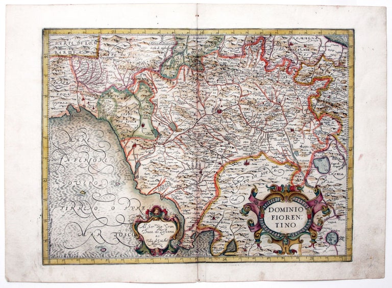
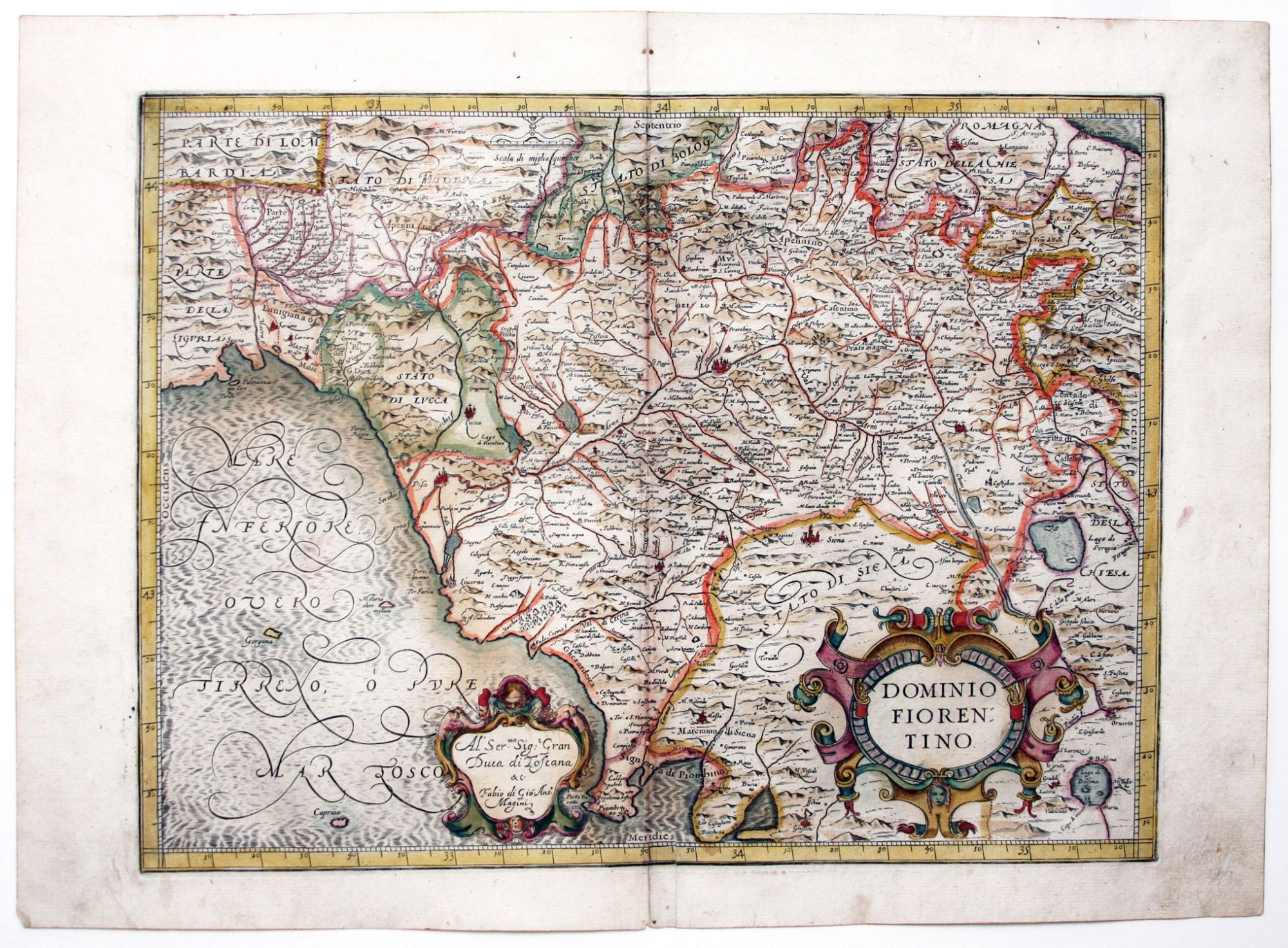
Dominio Fiorentino.
[Bologna, 1620]
13 ½ x 18 inches, Fine original color, refreshed; bit of centerfold abrasion, else excellent condition.
A scarce, richly engraved map of northern Tuscany from the first Italian national atlas. Florence is in the center of the map; Lucca and Pisa are to west; and Siena and Arrezzo are also included.
Price: $650.00
See all items in
Antique Maps
See all items by G. A. MAGINI