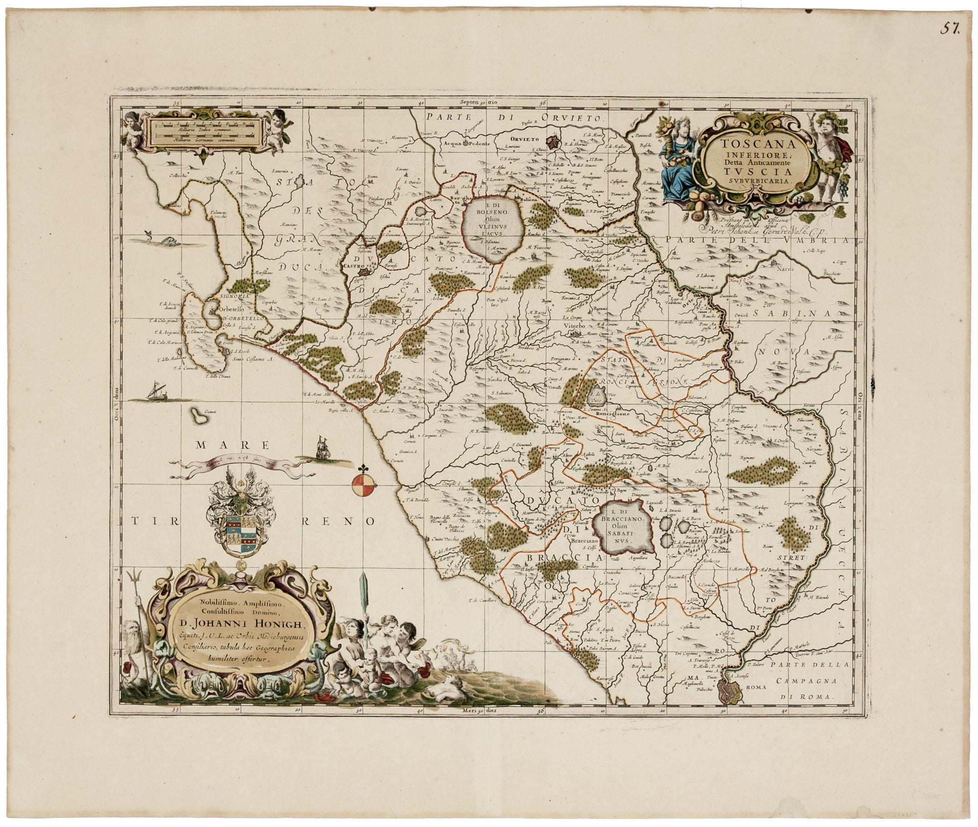
Toscana Inferiore Detta Anticamente Tuscia Suburbicaria.
Plate size: 41 x 49.8 cm (16.1 x 19.6 inches); sheet size: 53 x 63.5 cm (20.8 x 25 inches). With large margins. Fine original color; fine condition.
A richly decorative map, in a superb example, of the northern Latium region of Italy, depicting the area from Rome in the south to Orvieto in the north, and delimited by the Tiber River in the east. It appears that the map was never a regular component of the Jansson atlas, which would explain its scarcity.
Van der Krogt describes the map as an addition to just a few of Jansson’s atlases with no clear beginning date; the earliest date he gives is 1675. There is an especially elaborate dedication to the jurist, Johan Honigh of Middleburg, Zeeland.
The map was re-printed by Pieter Schenk and Gerard Valk from Jansson's plate ca. 1700.
*Van der Krogt 1, 406
Price: $1,250.00