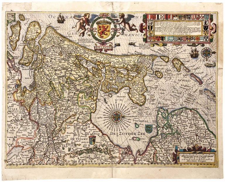
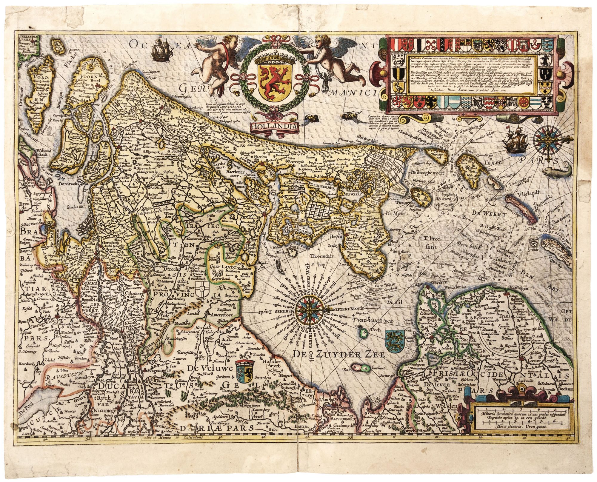
Hollandia./ Hollandia Comitatus…Anno 1617.
Superb hand color; reinforced separation lower centerfold & nearby mended split into surface; a number of marginal repairs, one at top just entering surface, a very strong impression; very good.
A richly engraved map of the Netherlands’ northwest province that includes the country’s administrative and trade centers of Amsterdam, Rotterdam, and the Hague. It appeared in “the first original atlas of the Netherlands published in folio size” (van der Krogt, p. 623). This was also the only folio atlas by Kaerius, who was a very prolific engraver for many Dutch map publishers. The central cartouche displays the provincial arms, while the arms of many of the region’s cities and towns surround the title at right.
Only three editions of the atlas appeared: two Latin of 1617 and 1622 and a French of 1621/22. This is from a Latin edition and likely a first edition by virtue of the strength of the impression.
* Van der Krogt 3400: 364.
Sold