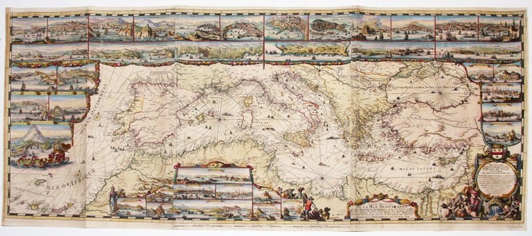
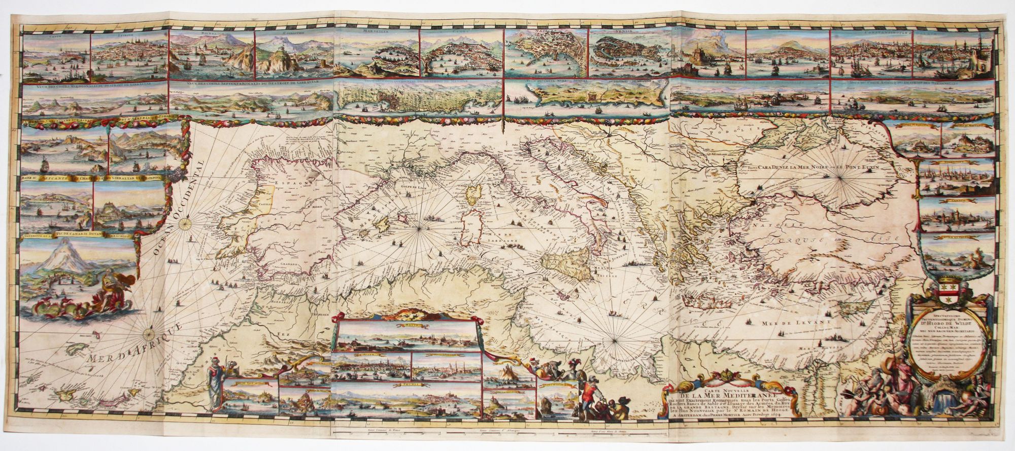
Carte Nouvelle de la Mer Mediteranee:….
23 x 55 1/2 inches. Fine hand color; fine condition.
Rare. A resplendent map in a bright, richly colored example. One of the most elaborate works of early mapmaking, it contains 38 insets of the major ports and cities of the Mediterranean. It was the centerpiece of the monumental atlas, the Neptune François: “the most expensive sea-atlas ever published in Amsterdam in the 17th century. Its charts are larger and more lavishly decorated than those of any preceding book of this kind” (Koeman).
The chart was etched and engraved by Romein de Hooghe, whose career was a rare case of an important artist of the day applying his talents to cartography. “Of all the fine Dutch map artists, Romein de Hooghe was perhaps the most outstanding” (Whitfield, p. 83). To achieve finer detail and greater elegance, de Hooghe employed the etching process for the port and city insets and the map’s several ornamental cartouches. The map itself, however, was produced by standard copperplate engraving.
The map was commissioned by William of Orange, then king of both England and the Netherlands. William would have most likely been familiar with de Hooghe’s work through the artist’s engravings that celebrated the military and political exploits of the monarch. In all, de Hooghe produced a series of nine charts for the Mortier atlas, with this one of the Mediterranean being by far the largest and most elaborate. Koeman, the great authority on Dutch maps, describes this group of maps as “the most spectacular type of maritime cartography ever produced in 17th century Amsterdam.” Campbell in Early Maps asserts that “when found in the full coloring characteristic of their time, they are among the most magnificent of any age.”
* Pastoureau p. 351 ff.; Koeman, Atlas Neerlandici, IV, M. Mor 7-9; cf. Campbell, T., Early Maps, pp. 96-7; Putman, Early Sea Charts, pp.22-23, pl. 7; Whitefield, P. The Charting of the Oceans, pp. 86-7 (illus.).
Price: $25,000.00