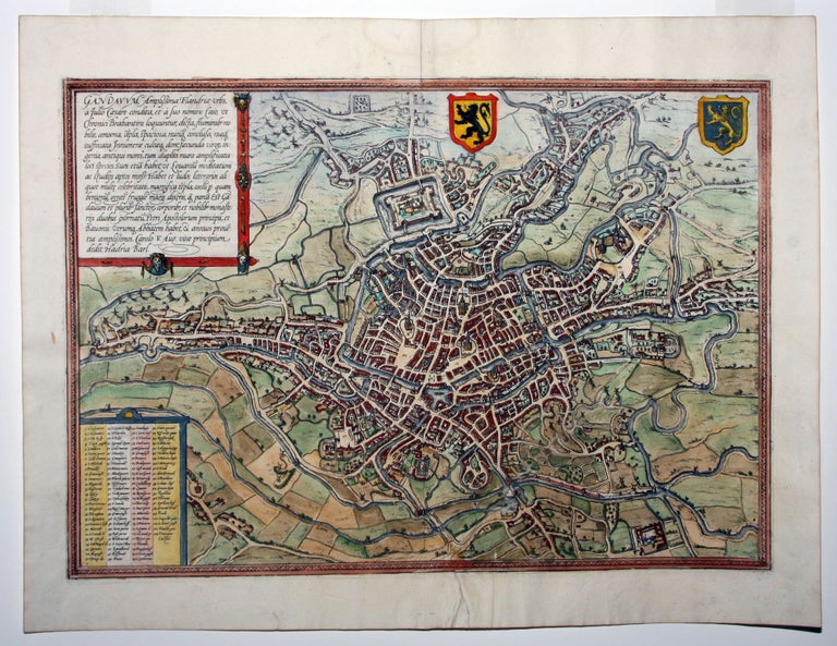
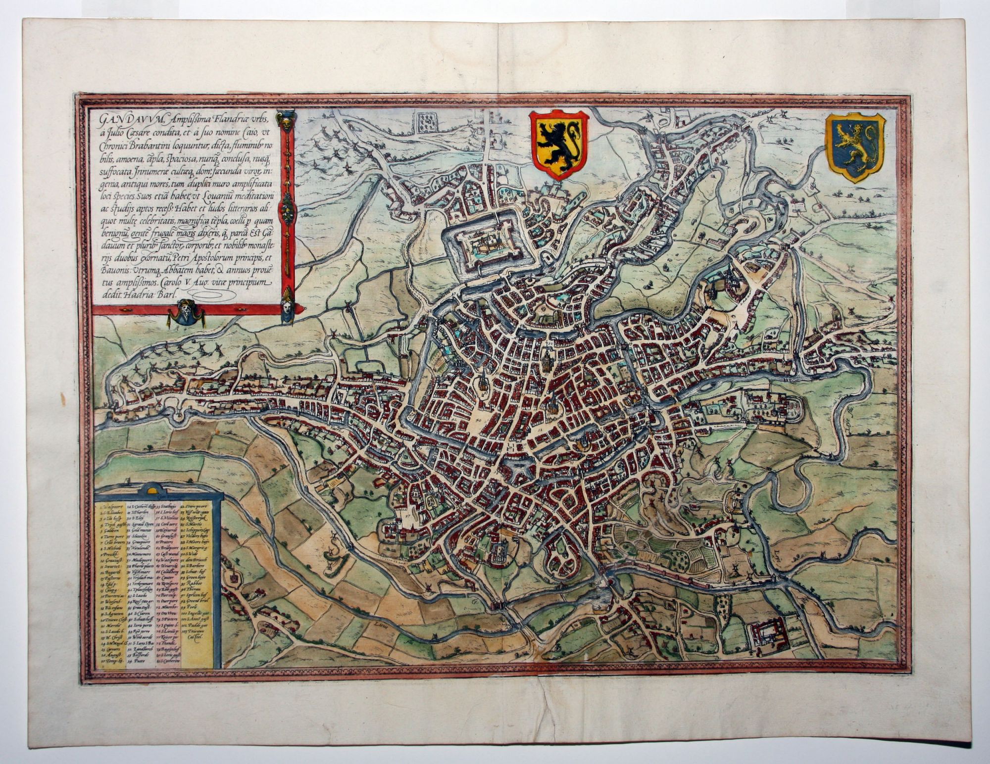
Ghent.
[Cologne, 1572]
Gandauum, Amplissima Flandriae Urbs.
13 x 18 ¾ inches, Superb hand color; expertly mended tear, very good.
One of the earliest plans of the third largest city in Belgium, situated at the confluence of the Schelde and Leie rivers. A numbered key identifies the city’s many landmarks, including the cathedral of Saint Bavo, the church of Saint Nicholas, and the famous Belfry of Ghent. This plan appeared in Braun & Hogenberg's Civitatis Orbis Terrarum, the first printed atlas of city plans and views.
Sold
See all items in
Antique Maps
See all items by G. BRAUN, F. HOGENBERG