
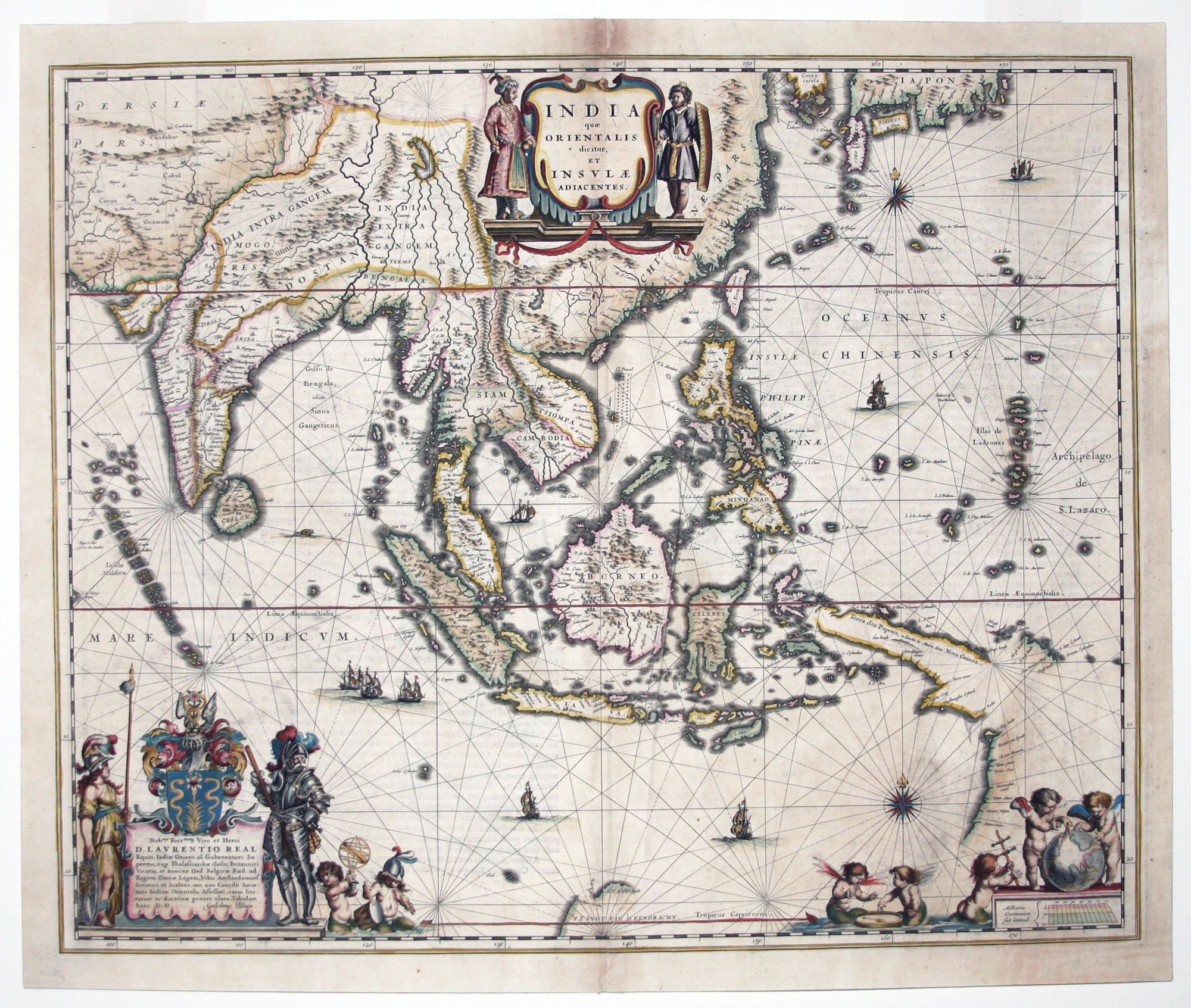
India quae Orientalis dicitur, Et Insulae Adiacentes.
16 ¼ x 19 ¾ inches. Fine hand color; some areas of reinforcement, else excellent.
An attractive example of the first Latin edition. “This fine map represented a marked improvement over the depiction of Southeast Asia on the map of the Asian continent…”—Suarez. It depicts the Spice Islands, the source of the wealth that underwrote the Dutch Golden Age, and it appeared at the height of Dutch power in the area. Its quality is in part attributable to Blaeu's position as the Official Hydrographer of the Dutch East India Company that he held since 1633. Blaeu's involvement with the Company is probably what prompted the extremely elaborate dedication in the lower left to a high official of the Company.
* Suarez, Early Mapping of Southeast Asia, pp. 201-03, fig. 115; Qirino, Philippine Cartography, p. 81.
Sold