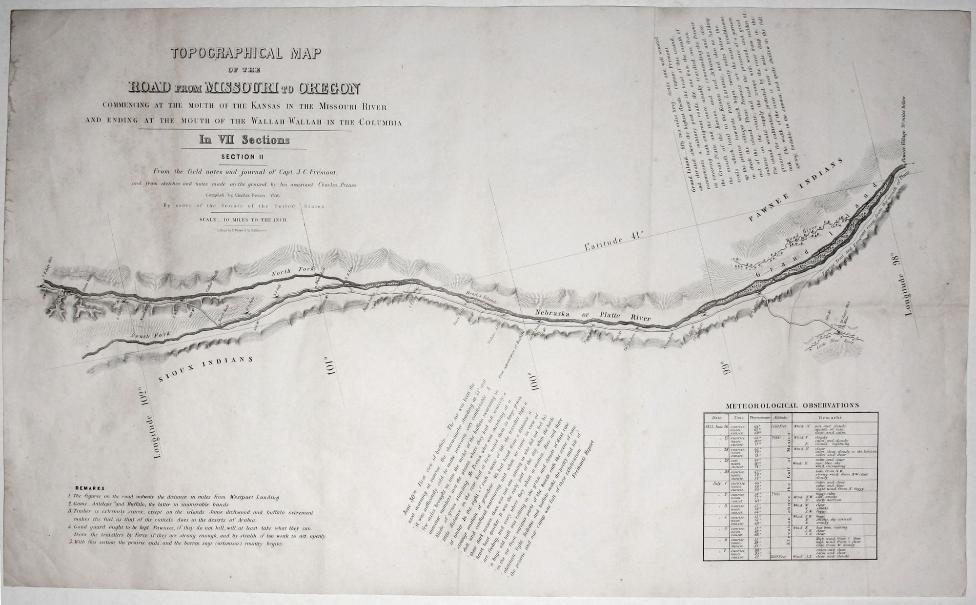
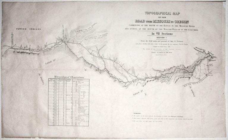
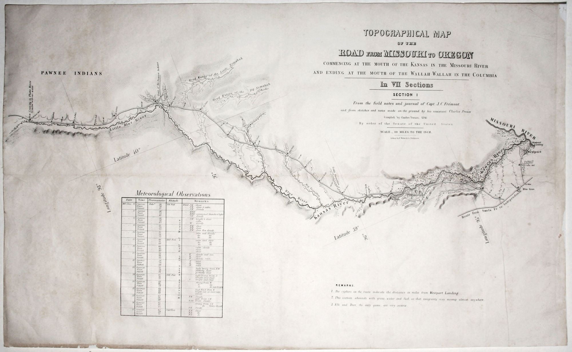
Topographical Map Of The Road From Missouri To Oregon…In VII Sections…From the field notes and journal of Capt. J. C. Fremont, and from sketches and notes made on the ground by his assistant Charles Preuss….
Seven folio sheets unbound, each approximately 13 x 24 ½ inches; occasional age-toning, minor fold mends, but overall very good.
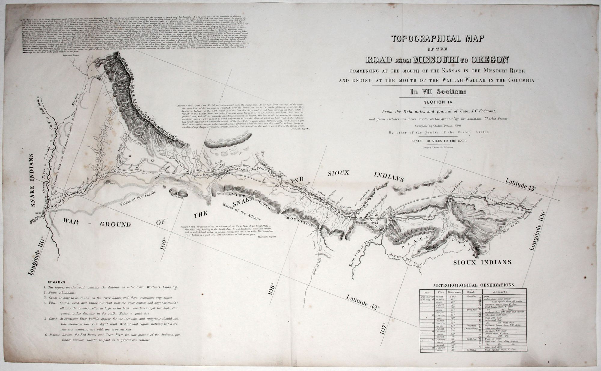
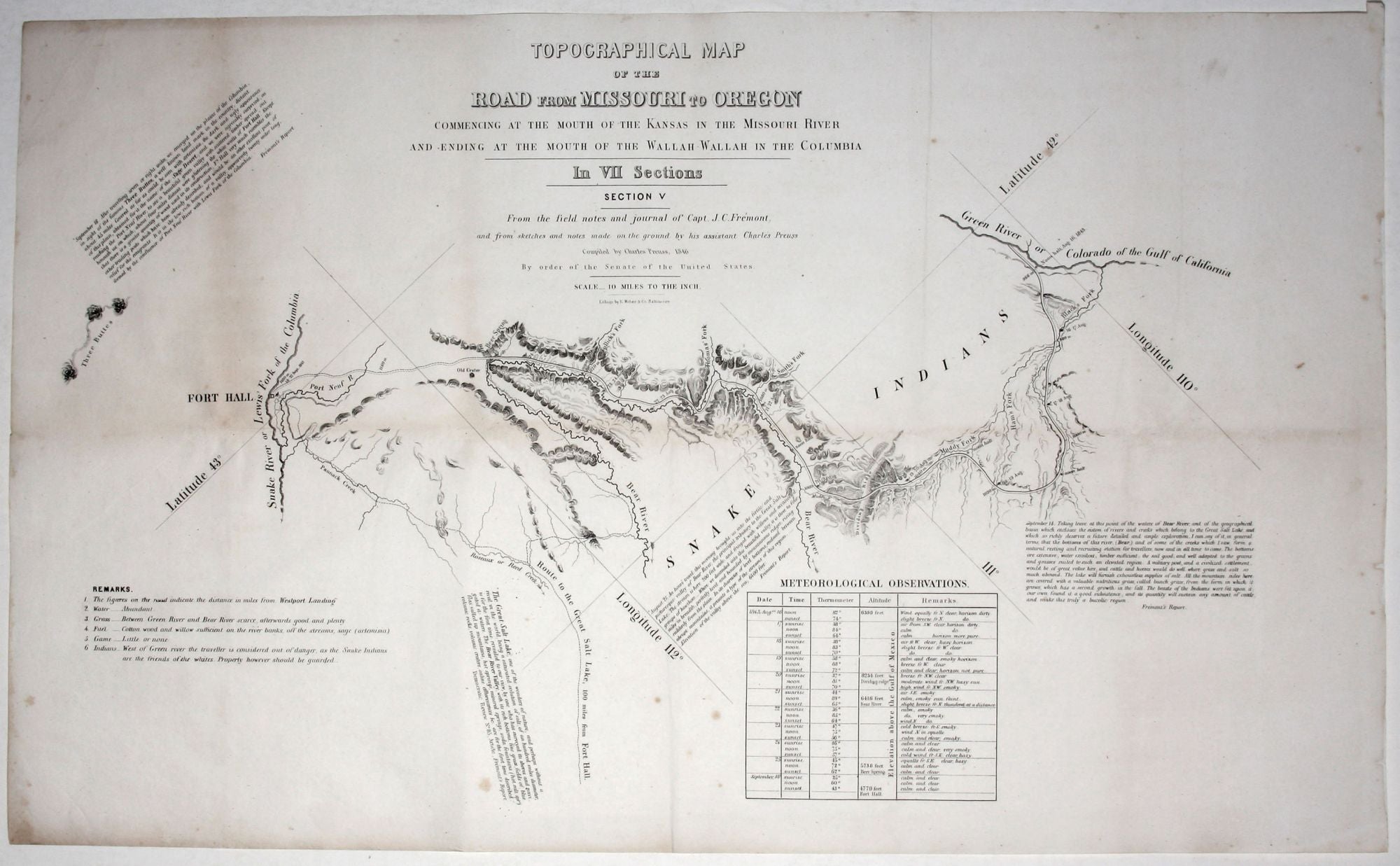
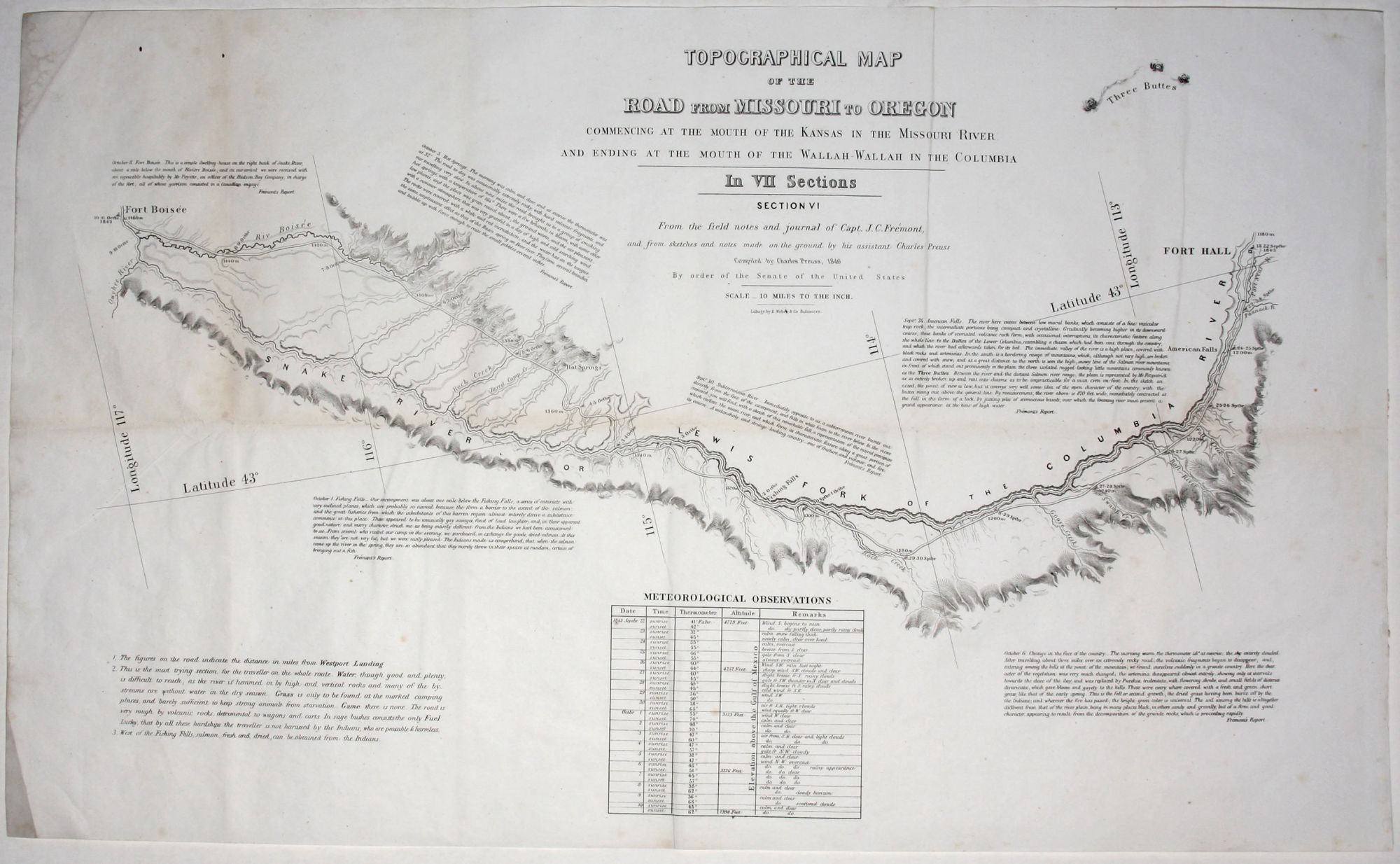
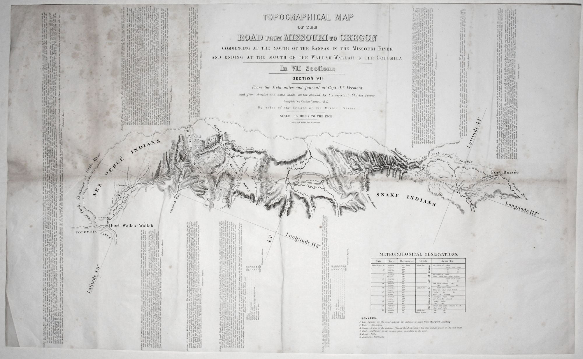
In a sense, this is the first “road map” of the United States’ first super highway—the Oregon Trail. “The first large-scale map of the Oregon Trail,…it is a guide for the westward-bound traveler by a mapmaker who had already traveled the route. In fact, most of the information is based on first-hand experience gained on the trail with Fremont. The seven-sheet map with a scale of ten miles to an inch was extremely detailed and practical to use, as a wagon driver could examine it one sheet at a time as he made his way westward” (Mapping the West).
“More than any other persons, John Charles Fremont and Charles Preuss dominate the cartography of the American West during the three years before the Gold Rush…”(Wheat). Preuss was Fremont’s official cartographer for his first two explorations—to the Rocky Mountains in 1842 and to Oregon and California in 1843-44. Preuss produced the present map in Washington, while Fremont was on his highly controversial Third Expedition to California.
Preuss’ map, with its reassuring double-lined route traversing the entire western half of the country and with its many, helpful notations, must have had the effect of allaying many of the fears of the emigrants who would use it. However, there is enough in the map to remind travelers of the more forbidding realities in store, as suggested in this note on Sheet 2: “Good guard ought to be kept. Pawnees, if they do not kill, will at least take what they can from the travelers by force if they are strong enough, and by stealth if too weak to act openly.” Also, beyond the scope of most maps, this one in various ways re-creates the immediate experience of traveling along the trail. Each sheet is accompanied with a tables describing climatic conditions and altitudes for specific days of Fremont and Preuss’ journey on the trail. Several sheets are further brought to life by extracts from Fremont’s Journal and Preuss’ Remarks covering the availability of game, wood, and water; the presence and disposition of Indian tribes, and other matters.
* Wheat, C. Transmississippi West, no. 523, vol. 3, pp. 25-29; Cohen et al, Mapping the West, pp. 136-38.
Sold