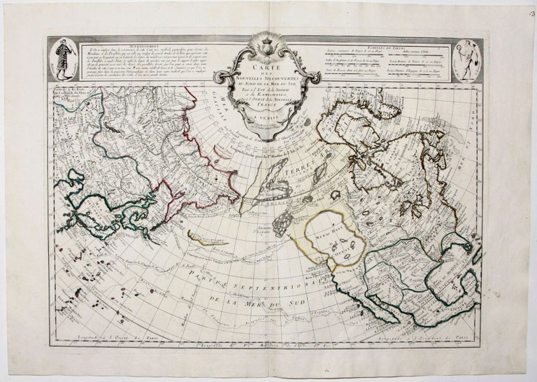
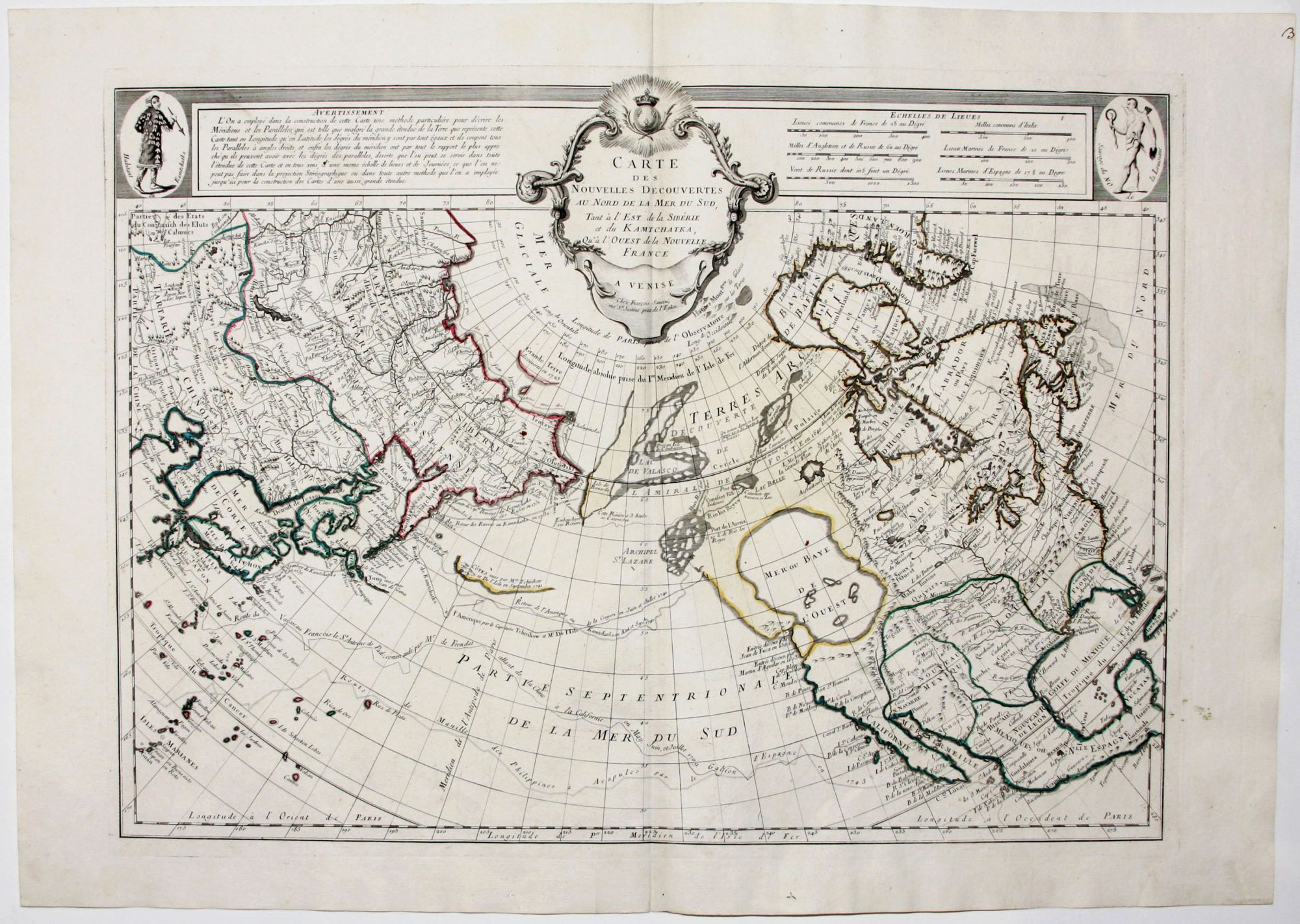
Cartes des Nouvelles Decouvertes Au Nord De La Mer Du Sud, Tant a l'Ouest de la Siberie et du Kamchatka Qu' a l'Ouest de la Nouvelle France.
18 x 24 ¾ inches, Original outline color; fine condition.
Beautiful example of the finely engraved Italian edition of this landmark map focusing on the northwest American coast and northern Pacific. The first edition of the map introduced some of the most influential cartographic fictions relating to this region: the so-called the Sea of the West and a complete Northwest Passage. However, it also incorporated information from the first two of Bering’s voyages, obtained by Joseph De l’Isle’s during his 20-years service as cartographer to the court of Russia. The enormous Sea of the West and the complex Northwest Passage depicted here would bedevil cartography until these areas were generally clarified during Captain Cook’s Third Voyage of 1776-79.
De l’Isle and Buache based their depiction of the Sea of the West on speculations made by Juan de Fuca regarding his 1592 voyage. The Northwest Passage was founded on the strength of a fictional voyage by an entirely imaginary, Admiral De Fonte, who in 1640 is said to have met a ship sailing west from Boston while he was sailing east through Canada. The De Fonte legend was the figment of the imagination of an English journalist writing in 1705 in the Monthly Miscellany. Not only did J. N. De l’Isle and Buache accept this tale whole cloth, but they also attempted to claim that these wild notions originated with the illustrious, Guillaume De l’Isle, J. N. De l’Isle’s uncle and the leading light of French cartography at the beginning of the 18th century. Perhaps the motivation for this egregiously spurious mapping was to motivate government officials to fund French voyages to northwestern America to establish French commercial interests there before their Russian and English competitors did.
* Tooley America p. 35, #104; cf. Schwartz/ Ehrenberg, pp.157-58, pl. 94 (p. 161); cf. Wagner, Northwest Coast, p. 159.
Sold