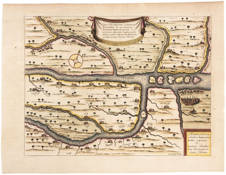
Vera Delineatio Civitatis Bassorae.
11 ½ x 15 ½ inches, Fine hand color; full margins, fine condition. A rare, beautifully colored map of southern Iraq of the confluence of the Tigris and Euphrates Rivers, focusing on Basra, shown in a small bird-s-eye view at lower right. Fifty-six place names on the map are in Arabic. It is among the few printed maps, this early, that we've seen that provides such a focused depiction in this part of the world. The map shows the locations of families belonging to Iraq’s Mandaean minority. Portuguese monks discovering this community in the 16th century had assumed it was a Christian sect, based on its baptismal rites and reverence of John the Baptist. This misinterpretation led the Mandaeans to be referred to as “Christians of St. John.”
Sold