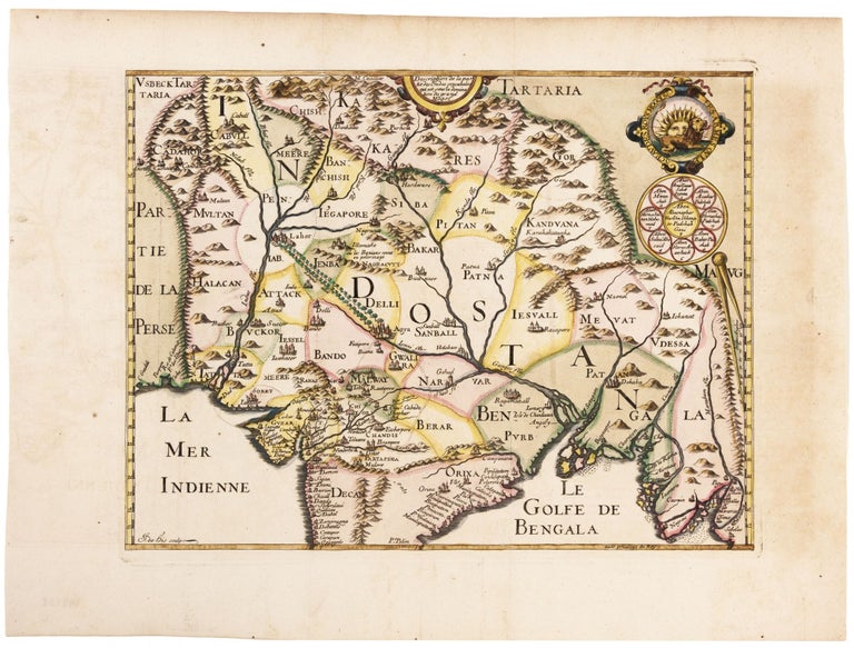
Description de la partie des Indes orientales qu est sous la domination du grand Mogol.
10 3/4 x 14 inches. Fine hand color; excellent condition. Very scarce, attractive map of the Mughal or Mogul Empire that controlled at its height much of India and Afghanistan from early in the 16th century; it gradually dwindled until its final defeat by the British in 1857. Its leadership was Muslim, though its origins were in central Asia and its culture Persianate. Agra, site of the Taj Mahal, occupies the approximate center of the map. The map is handsomely engraved and show several Indian cities as well as the tree-lined road between Lahor and Agra (near Delhi). The crest of the Mughal Emperor consisting of two rings is shown in the top right corner. The top ring encloses a lion facing the east, which partially obscures a blazing sun. The ring below encloses the Mogul dynastic genealogy. It appeared in Melchisedec Thevenot's rare compilation of voyage and travel accounts, Relations de divers voyages Curieux.
Sold