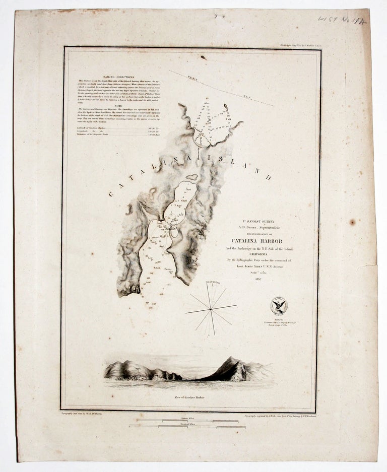
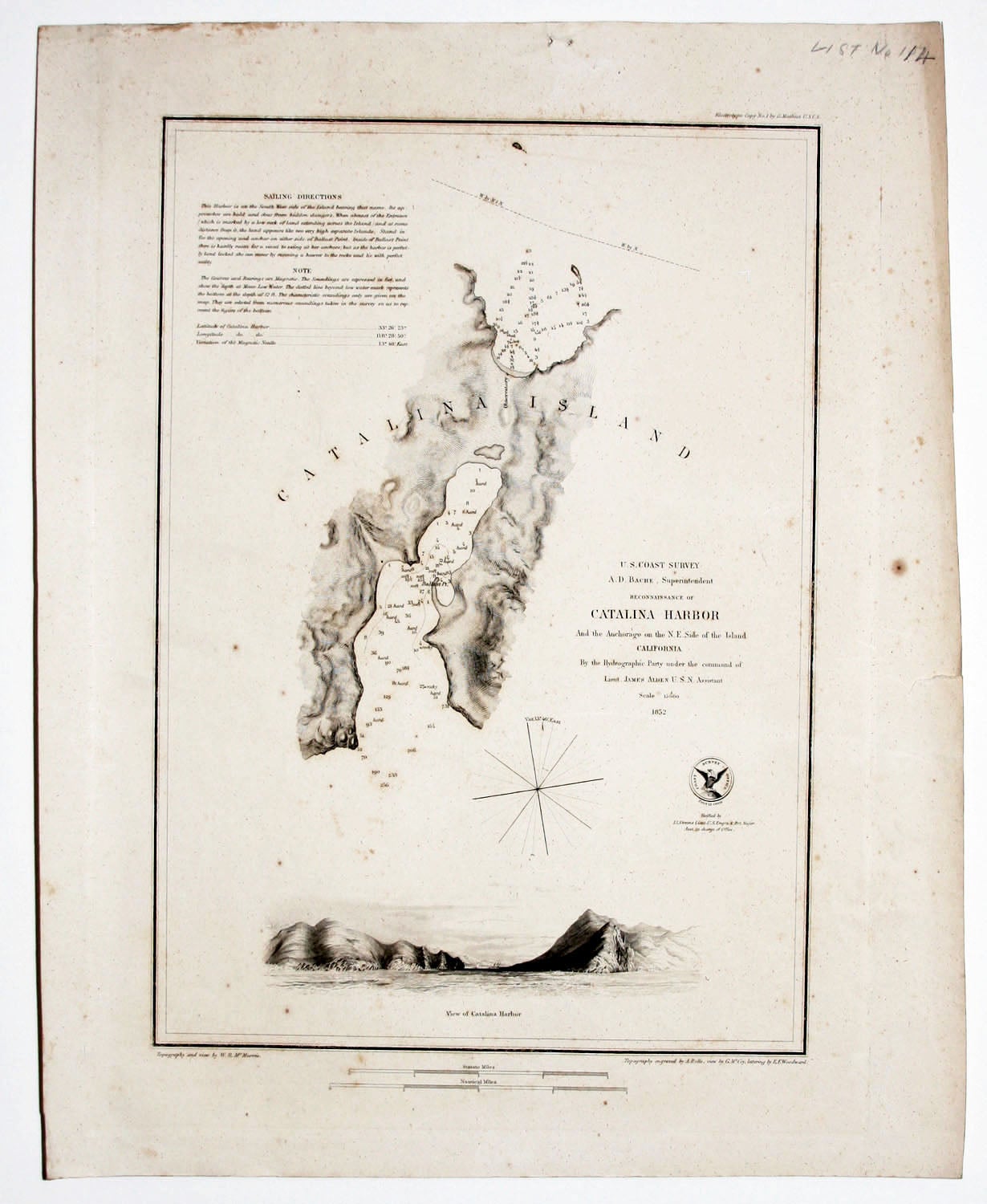
U. S. Coast Survey A. D. Bache, Superintendent Reconnaissance Of Catalina Harbor And the Anchorage on the N. E. Side of the Island….
5 ¾ x 10 ½ inches, Some light foxing & toning, small marginal mend, very good.
First state, separately published on heavy, unfolded paper; not from the Coast Survey’s Annual Report. What can be considered the beginning of the systematic scientific charting of the California coast commenced in 1848--only a few years prior to the publication of this chart—when the U. S. Coast Survey first extended its work to the newly acquired west coast of the country. In fact, the first comprehensive chart of the coast from San Diego to California (see reference below) was published the same year as this one. As was the case with several of the individual charts of harbors and bays along the coast, this one includes a delicately rendered view of its subject, which was the work of W. B. McMurtrie. The original survey of the harbor was commanded by Lt. James Alden. Textual sailing directions and notes for the navigator are provided at upper left
* Cf. Heckrotte, W. California 49, Map 33.
Sold