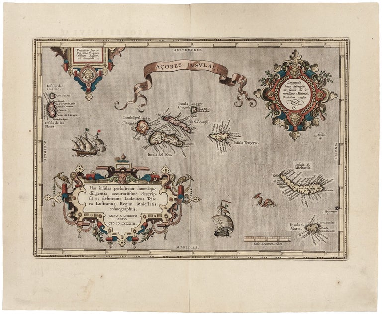
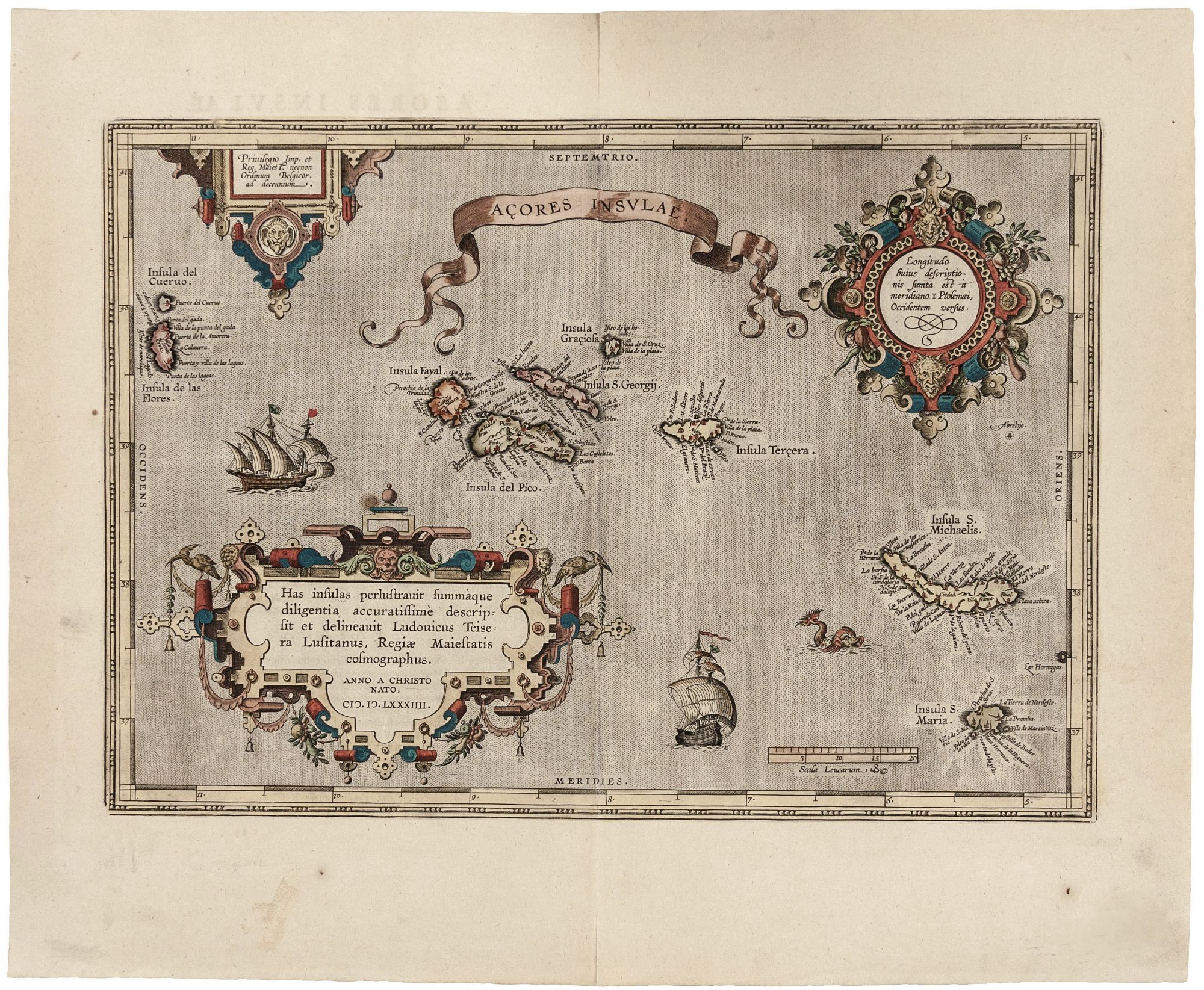
Açores Insulae.
13 x 18 1/2 inches. Fine hand color; excellent condition. A beautiful and remarkably detailed map, the first acquirable, accurate one of the Azores. It is predated only by the Bordone, whose schematic depiction of the islands gives the imaginary Brasil and Asmaide as much prominence as to the actual islands. Ortelius’ map dispenses with these fictitious islands, and those shown are replete with towns, mountains and streams. The map is superbly engraved with elaborate strapwork cartouches. Two sailing ships and a monster populate the stippled ocean. The pages of Theatrum Orbis Terrarum contain many maps that depict their subjects accurately for the first time, partially due to Ortelius’ success at finding good sources. As the Azores were throughout the age of discovery a Portuguese stronghold, it is only natural the best source should have been the Portuguese cartographer, Luis Teixeira, whose contribution to Ortelius’ atlasalso included a groundbreaking map of Japan.
* Van den Broecke 24.
Sold