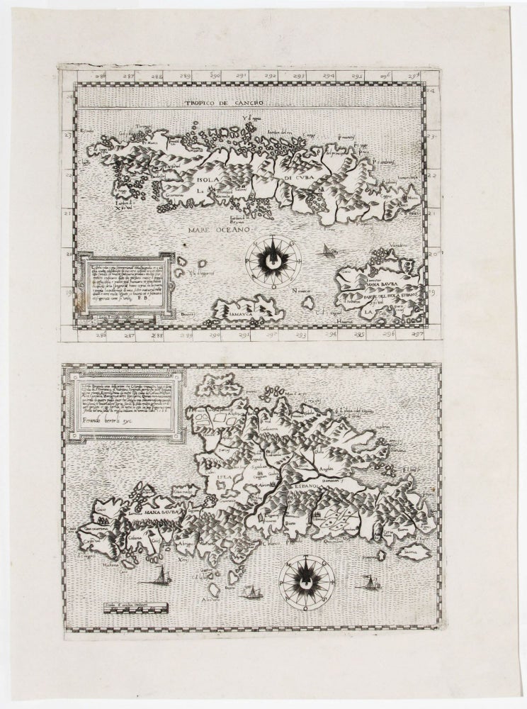
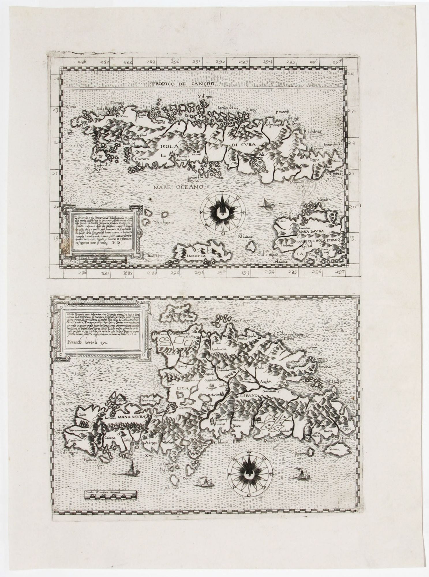
L’Isola cuba e piu setentrional de la Spagnola. . ./ L’Isola Spagnola . .
14 ½ x 9 ½ inches, Two maps on a single sheet; fine condition.
Separately published. These are among the earliest separate maps of their respective islands. The single sheet with the two maps appeared in a very rare, assembled-to-order, Italian atlas; such atlases are known under the generic name of La Freri, after the Roman publisher and bookseller, who compiled many of them. Maps of from the La Freri atlases were generally the most accomplished maps available worldwide prior to the Dutch period; many of them, in fact, served as models for the later Dutch maps. Both maps here are also superb examples of the restrained elegance that characterized the visual style of La Freri maps at their best.
Ferrando Bertelli at one time or another filled nearly all of the roles involved in map production having been an engraver, printer and publisher.
* Not in Cueto; Tooley in Imago Mundi III, maps 86 & 89, p. 21.
Sold