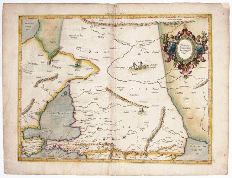
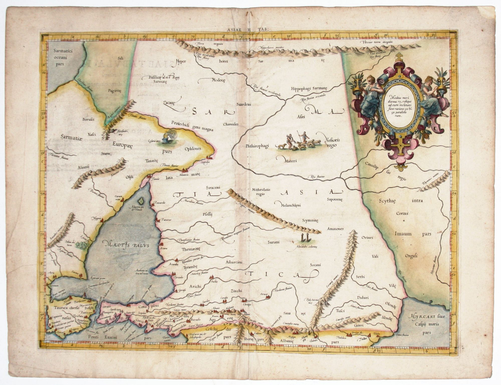
Asiae II Tab:.
13 ¾ x 18 inches, Fine hand color; slight offsetting & wrinkling along fold, else excellent condition.
The rare first issue of this very attractive map of southern Russia from Mercator’s definitive edition of Ptolemy’s geography. Meeting in this map are two of the most important figures in the history of geography. Geographic data and mapmaking instructions left by the Alexandrian, Claudius Ptolemy (fl. A.D. 127-180), became the foundation of mapmaking as we know it today. And it was Gerard Mercator (1512-1594), the great Flemish geographer, whose edition of Ptolemy was considered the most accurate. In particular, Mercator’s maps conformed more closely to Ptolemy’s original design than any of the several earlier editions. Mercator’s became the standard text, with many editions following this one as late as the 18th century.
Mercator in 1540 published Literarum latinarum, the first instructional handbook in the use of the italic hand to appear outside of Italy. It was also the first work to offer instruction in the use of italic script in the engraving of maps. The maps in Mercator’s Ptolemy are arguably the finest demonstrations Mercator provided in the use of italics. Moreover, “the beauty and legibility of the best sixteenth and severteenth-century Dutch maps can be traced in large measure to Mercator’s influence” (Karrow, p. 382).
* Karrow, R. Mapmakers in the Sixteenth Century, pp. 376-406.
Sold