
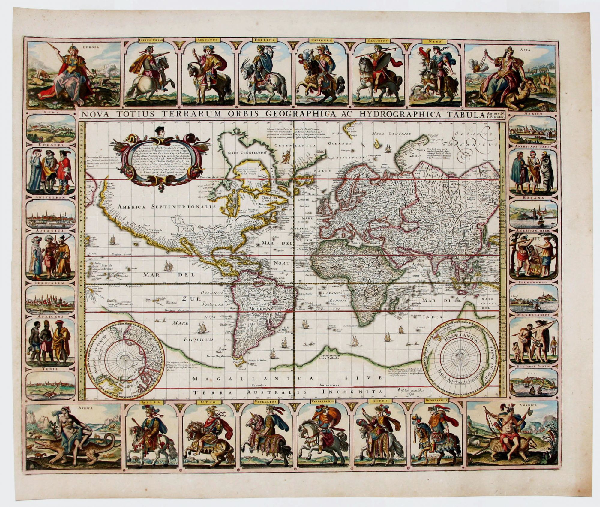
Nova Totius Terrarum Orbis Geographica Ac Hydrographica Tabula Autore. N. I. Piscator.
18 x 22 inches. Superb hand color; excellent condition. Rare; separately published. One of the most richly embellished, Dutch world maps acquirable today. This artistically ambitious work with vignettes along all four borders depicts 12 Roman Emperors on richly caparisoned horses in the top and bottom. In the four corners are allegorical female figures astride animals symbolizing the continents. In the side panels are city views and illustrations of figures in indigenous dress representative of various parts of the world. Jerusalem, Rome, Amsterdam, Havana and Mexico City are among the cities depicted. Though geographically similar to Blaeu's and Jansson’s world maps plotted on the Mercator Projection, Visscher’s work provided important updating, notably throughout eastern Canada, including Hudson’s Bay, where important explorations are reflected. Also, Tierra del Fuego is more clearly seen here as a distinct landmass, now no longer connected at all to the mythical Southern Continent. Curiously, the St. Lawrence River extends as far as the mid-point of the present-day United States, where it is fed by a lake. The map’s engraver is not named but was probably Pieter Goos, who engraved the companion hemispherical world map published a year earlier (Shirley 346) that is in a similar style. Also supporting Goos’s involvement in both maps is that the same error, dating the discovery of America 1592/ 1599, is repeated on both maps. In 1666, Goos would produce one of the most beautiful sea atlases of the Dutch period.
* Shirley 350.
Sold