Holy Land.
[Amsterdam, 1659]
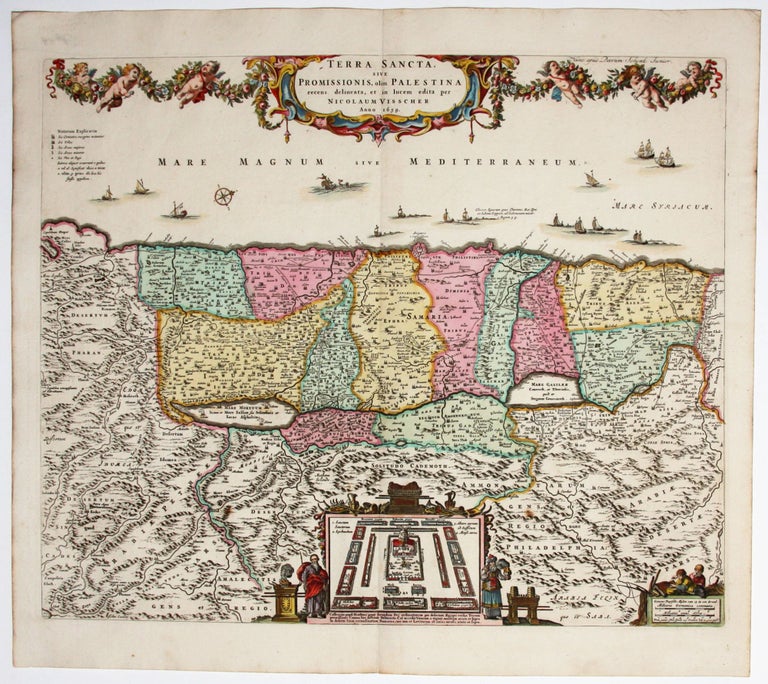
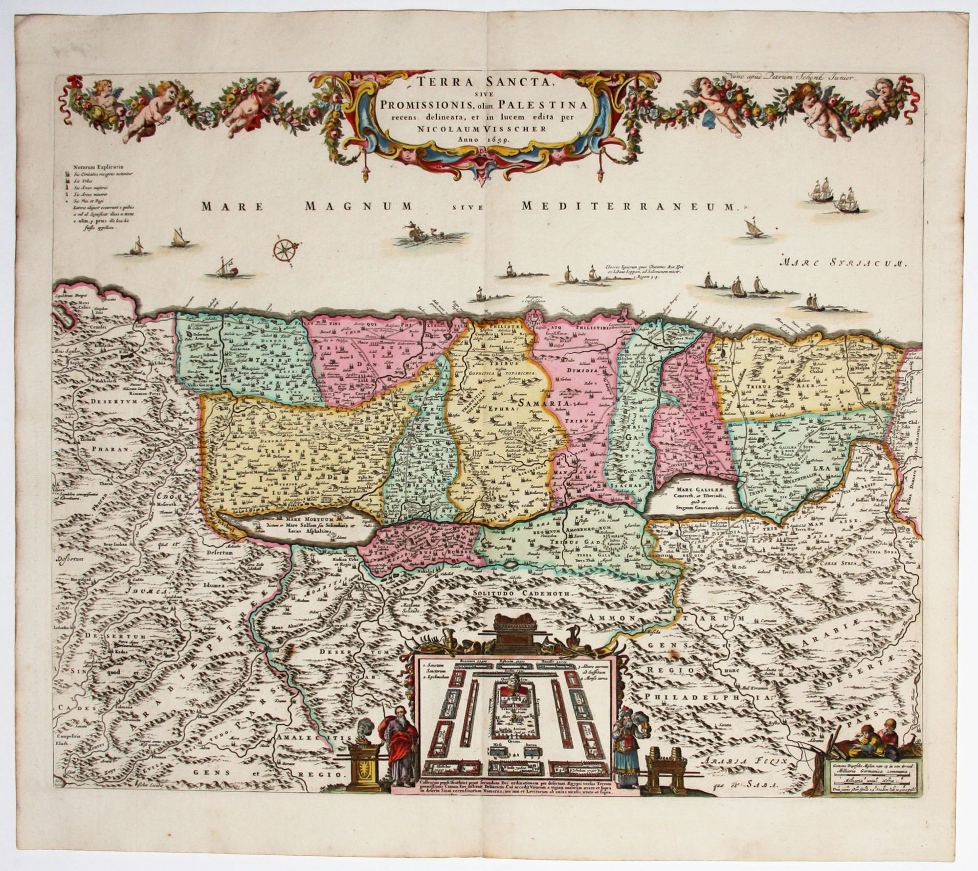
Terra Sancta, Sive Promissionis, olim Palestina.
18 x 21 ½ inches. Fine original color; fine condition.
One of the most distinctively decorated early maps of the Holy Land in a superb example. Among the map's exclusively Old Testament illustrations is an inset in the lower center showing the encampment of the Israelites during the Exodus flanked by the figures of Noah and Aaron. The map, based on Adrichom, is oriented with west at the top.
* Laor, E. Maps of the Holy Land #793.
Sold
See all items in
Antique Maps
See all items by N. VISSCHER