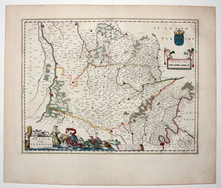
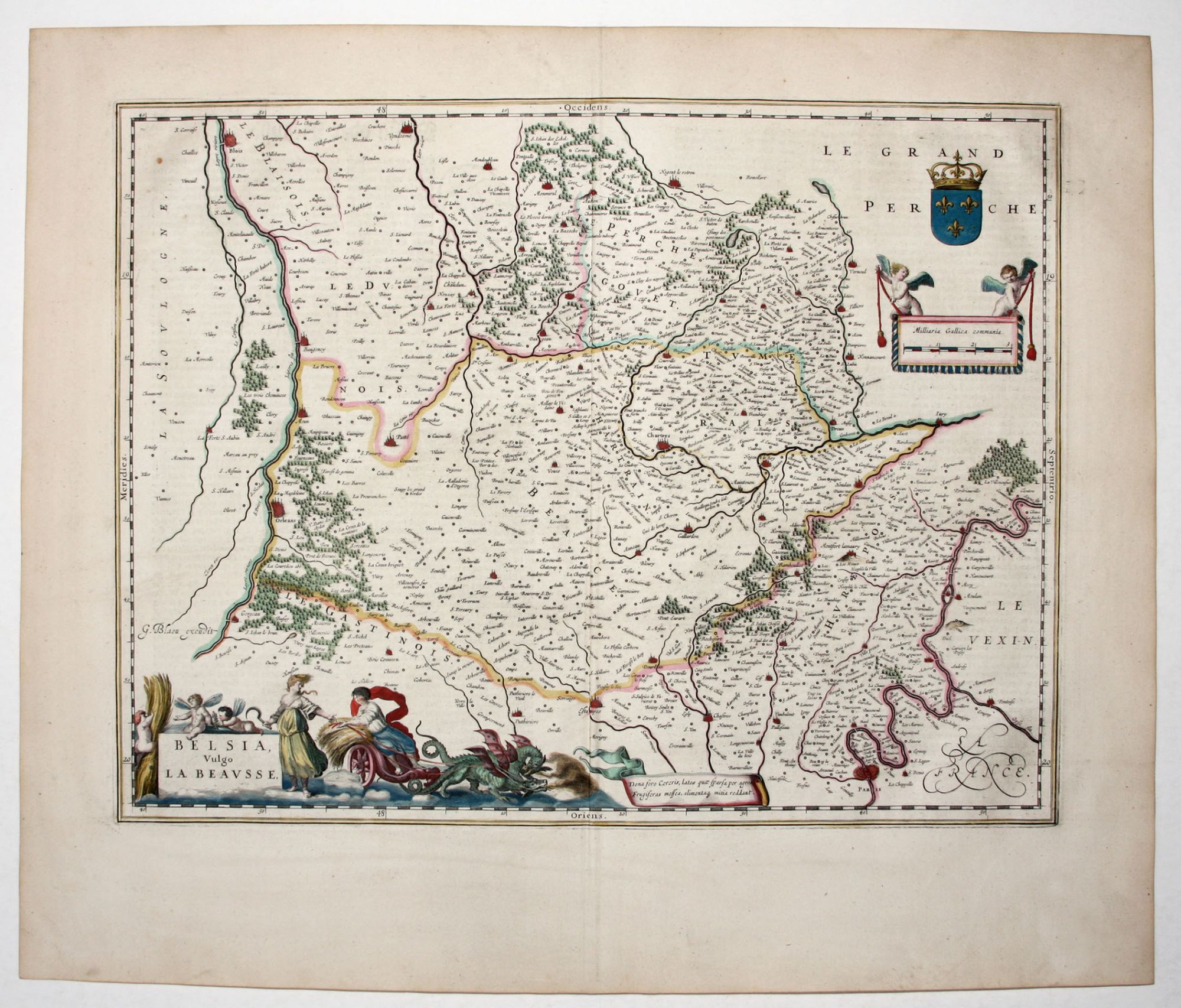
Paris/ Chartes/ France.
[Amsterdam, 1647]
Belsia, Vulgo La Beavsse.
15 1/4 x 19 3/4 inches, Fine original color; mint condition.
Superb example of a map with Paris at bottom right and the region to the southwest that includes Chartes, Orleans and Blois. (The map is oriented with west at the top.) The dramatic cartouche depicts Ceres in a dragon-powered chariot and other agricultural imagery suggestive of the region's produce.
Sold
See all items in
Antique Maps
See all items by W. BLAEU