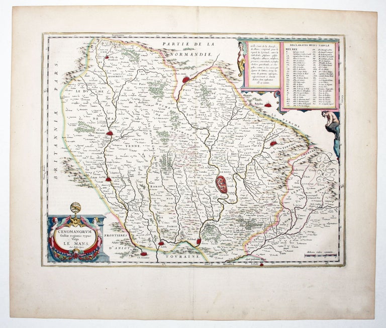
Le Mans, France.
[Amsterdam, 1647]
Cenomanorum Galliae Regionis typus Vulgo Le Mans.
15 x 19 ¾ inches. Fine original color; fine condition.
Beautifully colored map of the diocese of Le Mans in central France. The chief city, Le Mans, is shown on the map in a miniature city plan. The region was particularly well regarded for its churches. A text box in French informs the reader: “This map of the Diocese of Le Mans includes, for the gaze of the Religious, in addition to the cathedral, several college churches, abbeys, monasteries, priories, convents and parochial churches, and chapels…” An index in the upper right names more than fifty abbeys and churches, keyed to the map with letters. Bent under the weight of the list, a Satyr hangs his head – paganism defeated by sheer numbers.
Sold
See all items in
Antique Maps
See all items by W. BLAEU