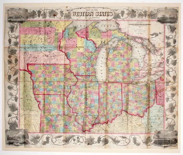
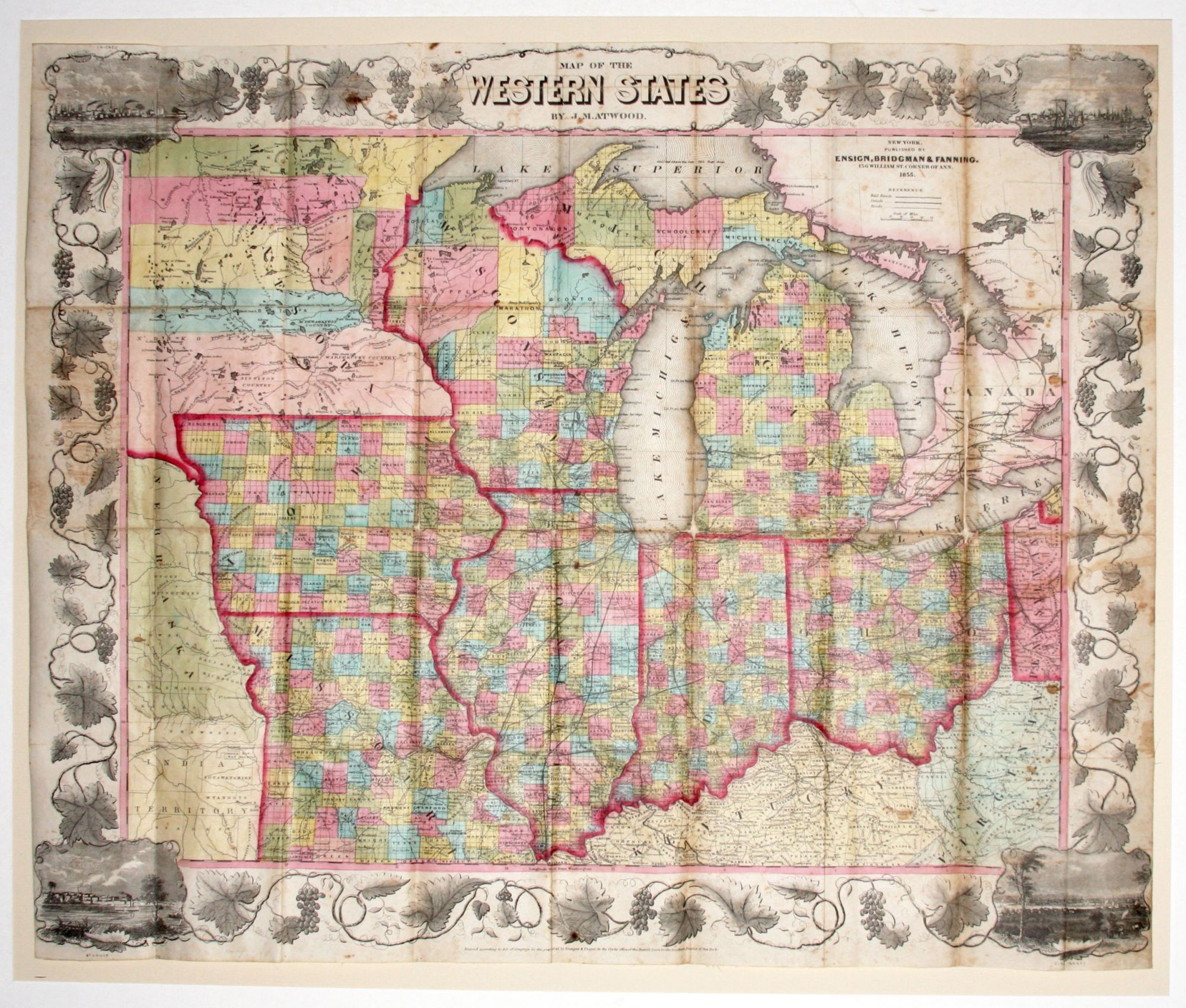
Map Of The Western States.
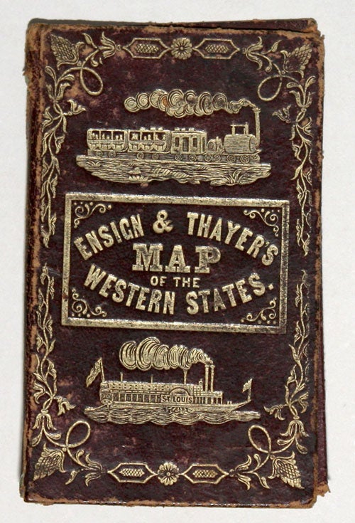
21 3/4 x 26 1/4 inches. Lithographed folding map with full original wash color, here flattened. [With:] Ensign & Thayer's Travellers' Guide... 1854. 33pp 2 pp. map catalogue in original maroon covers with nicely gold-stamped illustration and title; spine quite worn, covers less so, text detached; nice bright example of map with slight losses at fold intersections, few stains, overall near excellent.
A bright, attractive example of a map of what is here called the "Western States," but which covers all of today's Midwest, showing the states of Ohio, Michigan, Indiana, Illinois, Wisconsin, Missouri, Iowa and most of Minnesota, and including most of the Great Lakes. The map shows the primary area overlaid with the grid of the U. S. Ordnance Survey, and counties are named and differentiated by colors. In the corners are nicely detailed views of Chicago, St. Louis, Cincinnati, and Detroit. The Travellers' Guide accompanying the map provides detailed information--routes and schedules--of all then available modes of transportation-rail, canals, stage, road and steamship. Each state receives a general description, and much other useful data is provided.
Works such as this were very popular throughout the middle decades of the 19th century, providing a mobile populous with vital data for travel and the comfort of a densely detailed yet still warmly attractive map.
* cf. Rumsey 1824.003.
Sold