
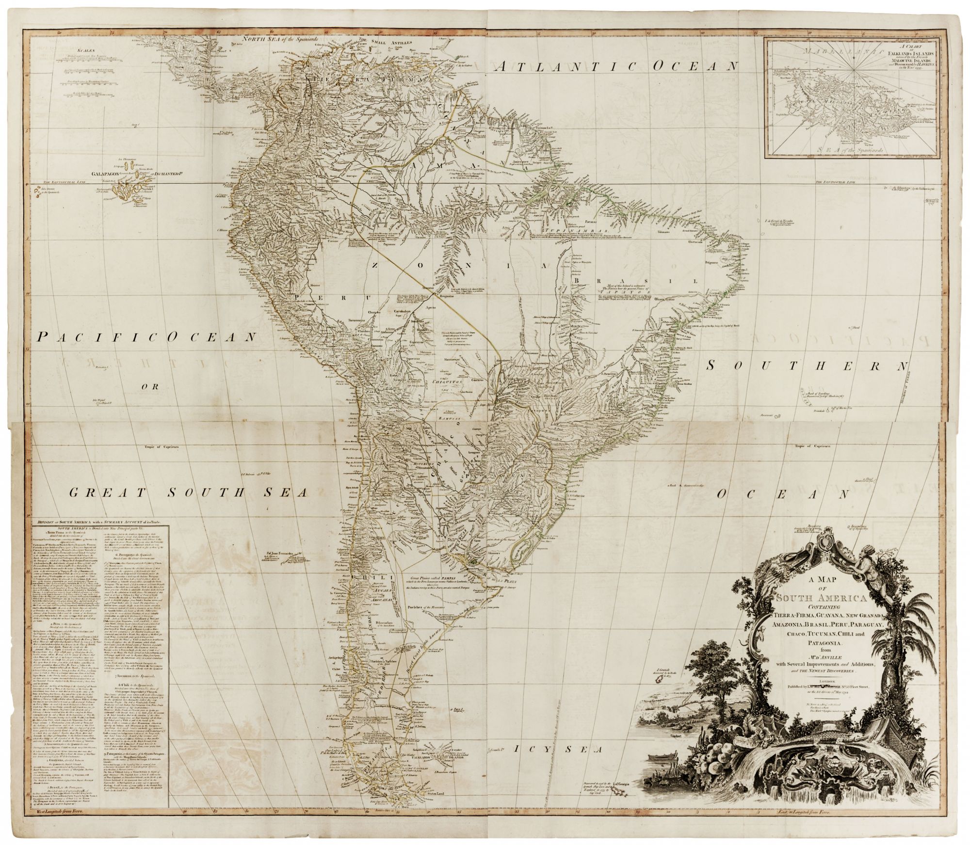
A Map of South America Containing Tierra-Firma, Guayana, New Granada, Amazonia, Brasil, Peru, Paraguay, Chaco, Tucuman, Chili and Patagonia.
Four sheets, joined in northern and southern pairs, each approximately 40 x 46 inches. Fine original color; some offsetting, some reinforced splitting at folds with no loss, overall good condition.
A richly detailed, beautifully engraved, large-scale map of South America. An elaborate cartouche depicts a flowing river scene with a parrot, monkey, and reptile amidst the vegetation. The Falklands, or Malouine Islands as named by the French, are detailed in an inset chart in the upper right corner. In the lower left, English text describes the political divisions of South America and gives a fascinating summary of its trade goods and strategic importance. For instance, of today’s Colombia and Venezuela, it is said that “The whole country abounds in Mines of Gold and Precious Stones…” Elsewhere the strategic importance of the Falkland Islands to the English is candidly described: “The Isles of Falkland belong to Great Britain by Right of first Discovery. The English have a Fort & Settlement at Port Egmont in Saunders Island, on the North of the Western Falkland, & the Spaniards have a Fort in the Eastern Isle. As Port Egmont, is a very safe & capacious Harbour, It will become of great utility to the British Navy & even to Privateers, in any future War, to annoy the Spanish Trade in the South Sea.”
Sold