
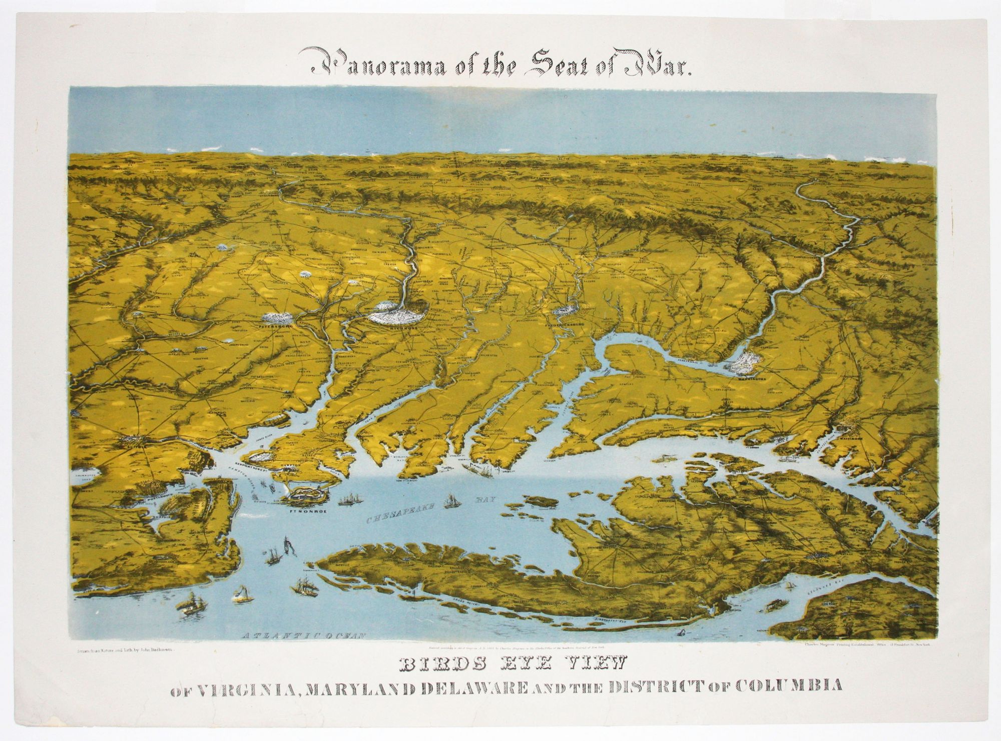
Panorama of the Seat of War. Birds Eye View Of Virginia, Maryland Delaware And The District Of Columbia.
21 x 28 inches, Chromolithograph; one mend in text area, else excellent condition.
A work of ingenious design that blurs the distinction between map and view. Its perspective is from much too high a vantage point to be considered a bird’s-eye view; it is, in fact, more satellite height in its perspective. Yet the work is too figurative to be strictly speaking a map. It is thus a unique hybrid of the two. (It is known that the Civil War saw the first extensive use of balloons in mapping, which may have suggested to Bachmann the use of this aerial perspective.)
The work brings to life one of the key theatres of the Civil War at the height of the struggle, and because of its unique perspective, it illuminates certain geographical factors that played an important role in the War. One is the importance of the Union blockade of the Chesapeake Bay, shown in operation in the view. The blockade prevented the re-supplying of several key Southern cities via waterways connected to the bay. Another point made clear by the view was the vulnerable position of Washington, DC due to its proximity to several Southern strongholds. Considering the scale of the view, a remarkable amount of detail is included, such as representations of several cities: Baltimore, Annapolis, Washington, Norfolk, Portsmouth, Petersburg, Richmond, Frederickburg, and others. The forts along the Chesapeake Bay and the road system of the entire area are also shown.
Sold