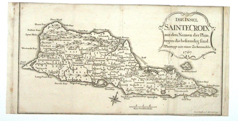
St. Croix.
[Nuremberg, 1767/ 1777]
Die Insel Sainte Croix mit den Namen der Plantagen die bestraendig sind.
6 7/8 x 12 5/8 inches. Bottom margin close, top margin trimmed with slight loss, very good.
Detailed, scarce map of St. Croix, divided into administrative quarters and showing the towns of Christiansted and Frederiksted. The map marks and names a great many plantations, using a symbol to indicate those equipped with a sugar mill. It appeared in Oldendorp’s “History of the Evangelical Brethren on the Caribbean Islands of St. Thomas, St. Croix and St. John,” the earliest history of the Virgin Islands.
Sold
See all items in
Antique Maps
See all items by P. KUFFNER