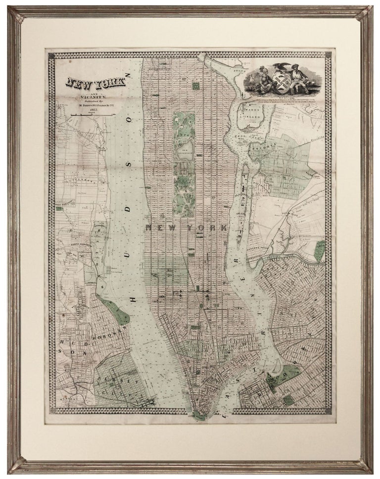
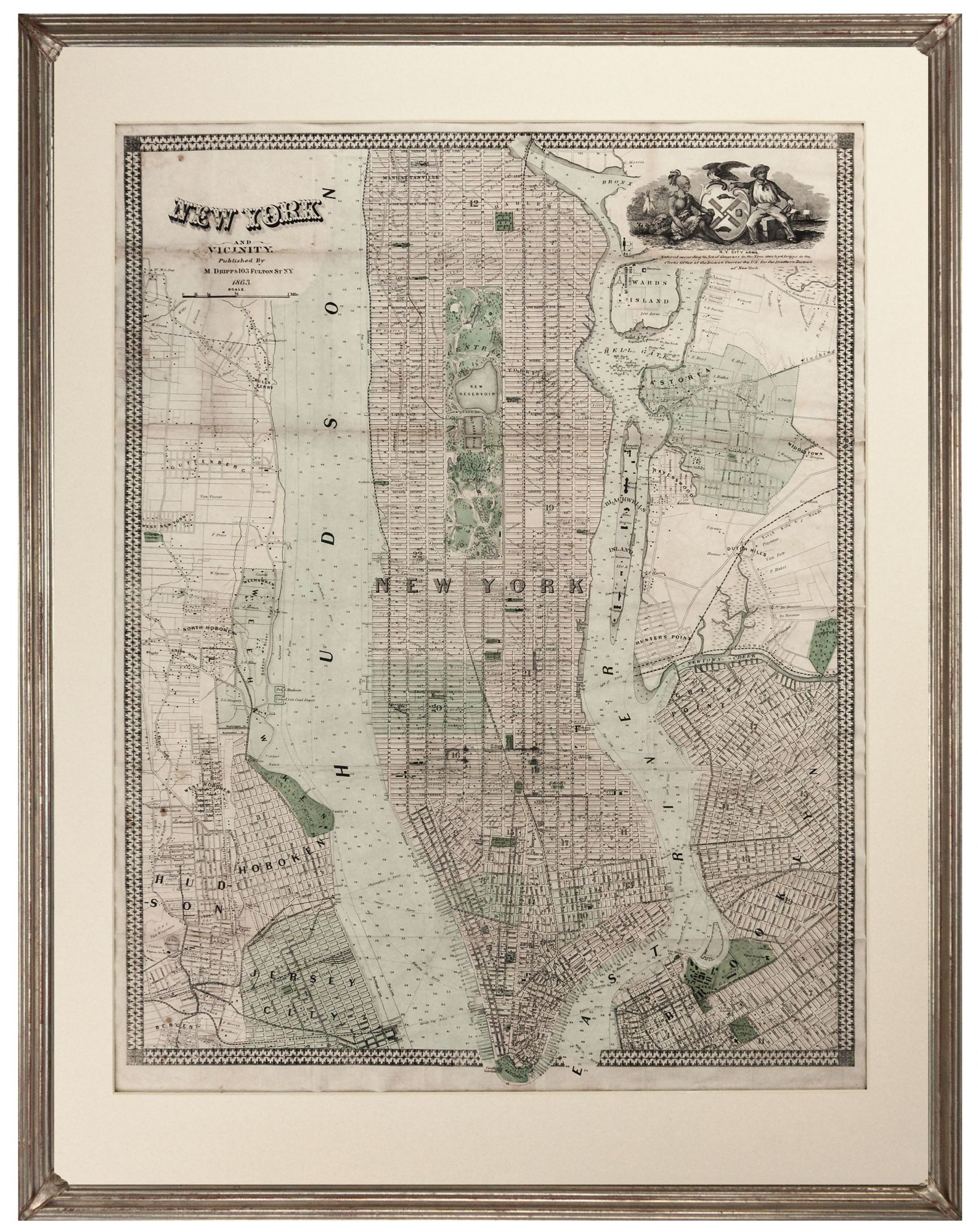
New York and Vicinity.
25 x 19 inches. Original color; backed with rice paper, very good overall.
A scarce, remarkably detailed map of New York City and adjacent cities as they were during the American Civil War. Adding an unique layer of depth to the detail of the map, Dripps provides the names of landholders throughout the region as well as the boundaries of their holdings. With the city street grid superimposed over these, this work presents more as a real estate map than a simple traveler’s map and this is a valuable source for the history of the region. The Hudson and the East River are filled with detail as well: depth soundings are given for both waterways, and ferry routes between Manhattan, New Jersey and Long Island are shown. Central Park is shown in its final layout according to the Olmstead Plan. The map also features, in the upper right, a lively version of the city’s coat of arms, as compared with the more static image of the official seal.
* cf. Haskell 1118.
Sold