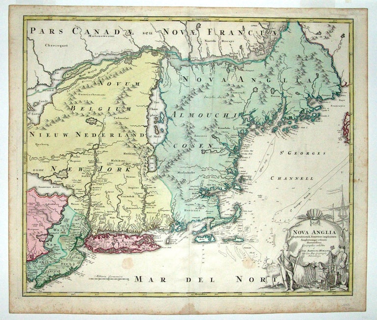
Nova Anglia Septentrionali Americae implantata.
19 ¼ x 22 ¾ inches. Fine original wash color; a crease, few faint stains, else excellent.
An excellent, original-colored example of one of the few collectible maps of the Northeast of the early 18th century. This attractive work is an interesting blend of older, Dutch sources and more recent English ones. The map shows that as the number of English settlements increased in the area, Native American tribal names are notably less plentiful than on Dutch maps of the previous century. Nonetheless, the attractive cartouche shows a European bartering with an Indian for an animal pelt, one of the mainstays of the early New England economy. The cartouche also reveals what the European was offering for trade, including beads, a barrel (presumably filled with liquor), guns, hatchets, tools, and textiles.
The cartography of Martha's Vineyard and Nantucket is still quite distorted, but the coast of Maine is well detailed. Curiously, the map shows a strait in Cape Cod connecting Cape Cod Bay and Nantucket Sound in the area of Eastham and Wellfleet. Historical accounts and early maps and charts indicate that there existed a water passage in this area from the mid-17th to the first part of the 18th century. New Jersey is divided into East and West Jersey on the map.
* McKorkle, B. New England in Early Printed Maps, Map 724.1.
Sold