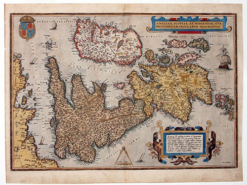
Angliae, Scotiae, et Hiberniae, sive Britannicar: Insularum Descriptio.
13 ½ x 19 ½ inches. Fine hand color; excellent condition.
The first modern atlas map of the British Isles, and one of the most attractively engraved of the period. "Ortelius' British Isles map is distinguished by a more sophisticated and ebulient style of engraving than most of the German and Italian examples hitherto. The cartouche containing descriptive text is surrounded by ornate strapwork; there is a royal coat of arms, a compass and scale, and five ships" (Shirley). The map is based on Mercator’s extremely rare wall map of 1564, of which Shirley was only able to locate three copies. This is the first issue of the map with German text on the verso.
* Shirley, no. 86, pl. 22; van den Broecke 16.
Sold