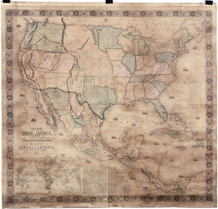
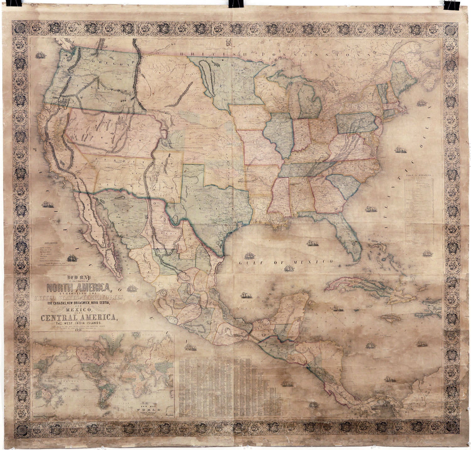
New Map of That Portion of North America, Exhibiting the United States and Territories.
55 ¾ x 58 ½ inches. Vibrant original color; archivally re-mounted on new Belgian linen and fully stabilized; few areas of reinstatement, else excellent of this kind.
Majestic wall map of the United States, which appeared at a pivotal moment when the country was beginning to expand to its full continental extent. Published only a few years after the start of the California Gold Rush, the map pays particular attention to the gold region, which is prominently labeled and given its own color. It also has excellent detail for Texas, which became a state in 1845. The expansion of the United States as a result of the Mexican War in 1848 is reflected in the map with references to the borders ratified by treaty. The routes of Fremont’s (1845) and Kearney’s (1846) explorations throughout the West are shown. The then recently formed territory of Oregon is shown as well. In the lower left is an inset of a good-sized world map showing the track of Wilkes’ circumnavigation of the early 1840’s, during which part of Antarctica was explored.
* Rumsey 602.
Sold