
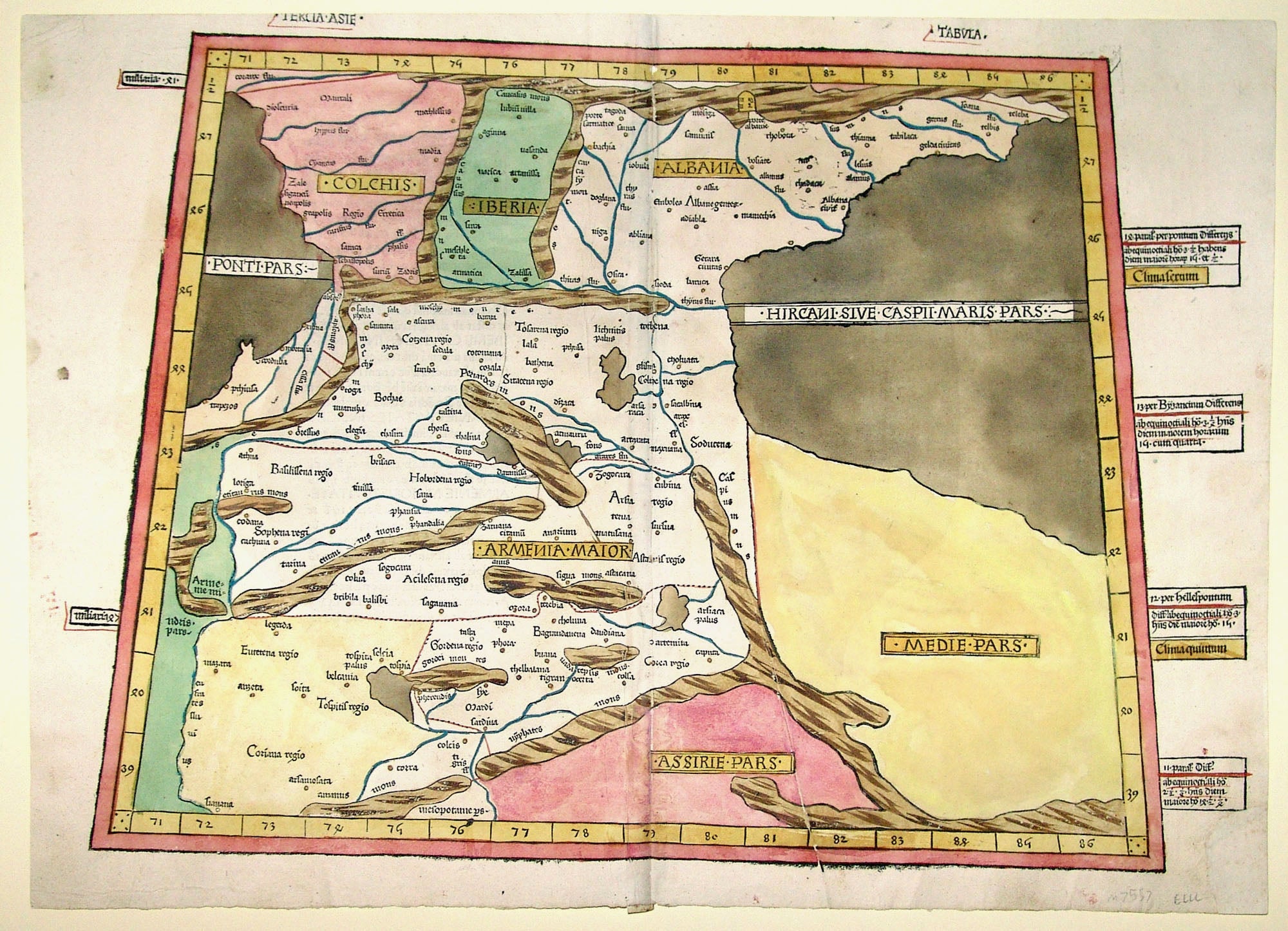
Tercia. Asie. Tabula.
15 ¼ x 21 ½ inches. 395mm x 550mm, Full original color; title slightly cropped, re-cornered at lower right with virtually no loss of printed surface, else excellent condition.
Rare and striking example, in vibrant original color, of one of the earliest printed maps to name Armenia and to focus on the Caucasus and Georgia regions. The map was prepared by Dominus Nicolaus Germanus, a Benedictine monk from Saxony. He was also the author of several manuscript copies of Ptolemy’s Geographia, which were used as the basis of some of the early printed versions of the work. The Ulm edition of Ptolemy Geographia, in which this map was published, was the first atlas printed from woodblocks, and the only early edition of the atlas whose maps were colored at the time with any regularity. The coloring of this particular map is consistent with that associated with the second, 1486 edition of the atlas
Sold