
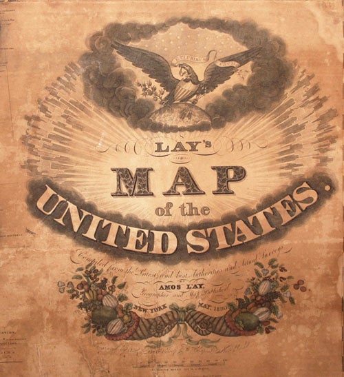
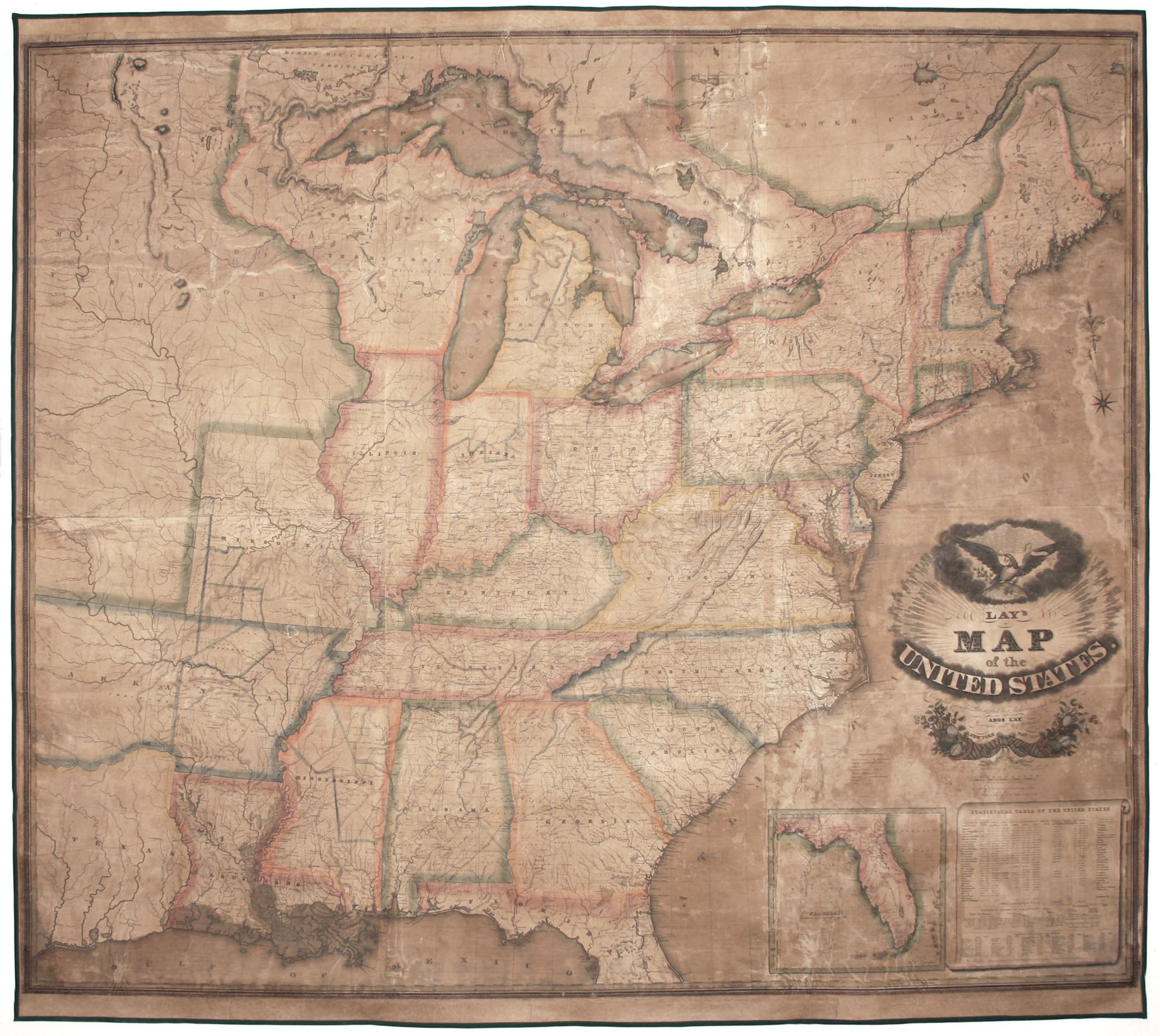
Lay's Map of the United States. Compiled from the Latest and best Authorities and Actual Surveys….
On six joined sheets, measuring 54 ¼ x 60 1/2 inches. Fine original color, refreshed; expertly conserved & re-mounted on new linen; moderately toned, occasional losses & splitting; fair to good condition.
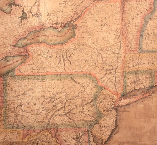
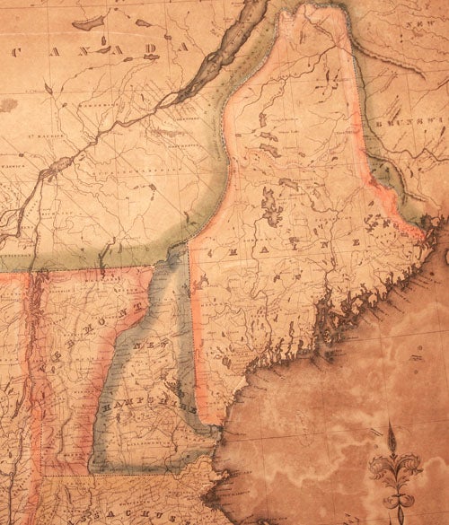
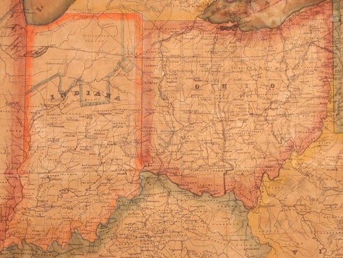
A very rare edition of this large-scale, visually impressive wall map the United States. Originally published in 1827, it was presumably updated in this edition. OCLC records copies of the 1827 and 1832 editions but not of this one of 1830. The map captures the country at an important point in the development of its transportation infrastructure. The Age of the Canal is seen on the map at its peak, with a truly remarkable number of them both shown and named in the northern tier of the country. The nation’s road system, which would greatly develop in Andrew Jackson’s administration, is shown at the beginning of an era of significant improvement. Also shown in its initial stage are the proposed rail lines that would make soon make most canals obsolete.
The map covers what is the present-day United States to somewhat west of the Mississippi River, including the eastern portion of Texas. The entirety of the Great Lakes and southeastern Canada are also shown. The map reflects a period when no new states had been added for several years, but when the existing Mid Western states and the territories were developing. On the map, Arkansas Territory includes part of present-day Oklahoma; the North West Territory is comprised of the Upper Peninsula of Michigan, Wisconsin and the portion of Minnesota east of the Mississippi River; and present-day Lower Michigan is labeled Michigan Territory. To the west is a large region labeled Missouri Territory and the part of Texas (prior to statehood). Florida is shown only partially in the main map but in its entirety in an inset at lower right.
There are population tables at lower right, providing numbers for the states and major cities as of 1820. Of particular interest is the relative number of slaves at this time, comprising 16 per cent of the country’s total population, while free African-Americans were at about 2 ½ per cent. The "Explanation" above the Florida inset provides symbols for state lines, county and district lines, roads, counties, towns, "Indian Villages," canals, forts and falls as they appear on the map. Rivers and tributaries are delineated in detail; mountain ranges are shaded to look three-dimensional; and coastal waters are also shaded. The states and territories are outlined and shaded in various colors.
An elaborate cartouche is surmounted by a dramatic illustration of an eagle grasping an olive branch and arrows in its claws, perched atop the earth in a blaze of sunlight. Beneath the title is a pair of neoclassical cornucopias overflowing with fruit, emblematic of abundance and prosperity.
Amos Lay (1765-1851) was an active New York mapmaker and publisher, who specialized in large-scale maps. His earliest known map was of the northern portion of New York State, published in collaboration with Arthur J. Stansbury in 1801. Between 1822 and 1826, Lay published four editions of a large New York State map. He first published a wall map of the United States in 1819, which was revised and republished several times until 1836. A team of three engravers labored on the present map. They were the brothers, Orramel Hinckley (born 1798) and Daniel Scrope Throop (b. 1800), and William Chapin (1802-1888).
* Groce, George C. and Wallace, David H. The New-York Historical Society’s Dictionary of Artists in America 1564-1860. New Haven: Yale University Press, 1969. p. 629; Ristow, Walter W. American Maps and Mapmakers, pp. 99 and 103.