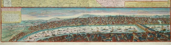
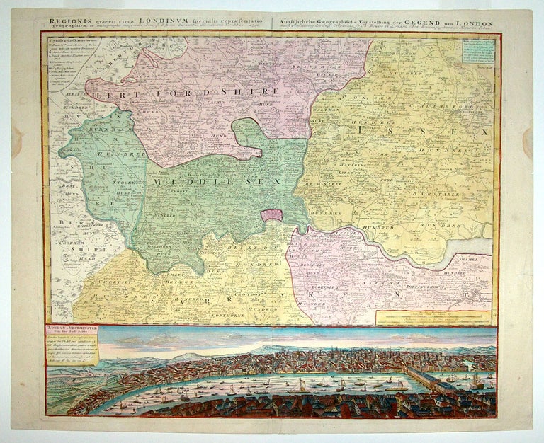
London & Vicinity.
[Nuremberg, 1741]
Regionis quae est circa Londinum.
19 ¾ x 22 1/8 inches. Full original wash color on map, fine later color on view; excellent.
Richly detailed panorama of London, notable for showing the growth of the city in Westminster and points to the west. Both the densely developed, expanding city and the river congested with all manner of nautical craft as seen here portray London as fully recovered from the disastrous fire of the previous century. The map shows London in its regional context and includes all of Middlesex, much of Hertfordshire and Essex, and parts of Kent, Surrey, Burnam Hundred, and Berkshire. Roads and the names of estates and palaces are shown throughout the map.
* Howgego 88.
Sold
See all items in
Antique Maps
See all items by HOMANN HEIRS