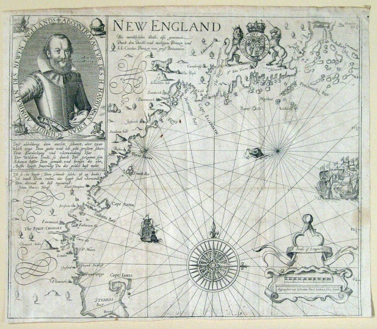
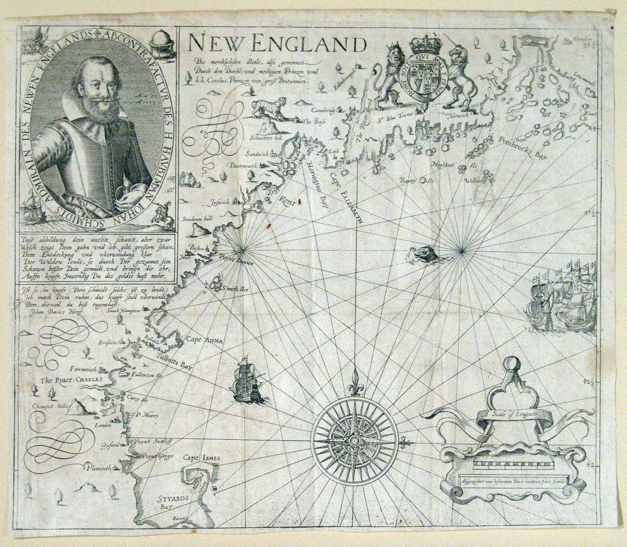
New England.
11 5/8 x 13 1/2 inches. Mend & abrasion with slight loss in ocean area upper right; lower left margin extended, no loss; bright with a firm impression, overall very good.
"The foundation map of New England cartography, the one that gave it its name and the first devoted to the region." (Burden 187) This very scarce Hulsius edition was published the year following the original English edition. It is a virtually exact re-engraving of the very rare first state of this landmark map and includes the splendid portrait of Smith.
Smith's "New England" is one of the few maps that is not only a primary historical source but also in fact influenced history. It was consulted by the Pilgrims prior to their voyage to America, and Smith's laudatory account of the Plymouth area (which Smith named) induced the Pilgrims to settle there, after their first landfall on Cape Cod proved unsatisfactory. Few of the other place names on the map survived. To curry favor with the court, Smith allowed the young Prince Charles to select the place names, all of which referred to members of the Royal Family and nobility.
There are nine states of the extremely rare English edition, many of which were published well into the 1630's. Unlike Smith's map Virginia, which abounds in later derivatives, this map was not re-published in any other form until the late 19th century.
* Burden190.
Sold