
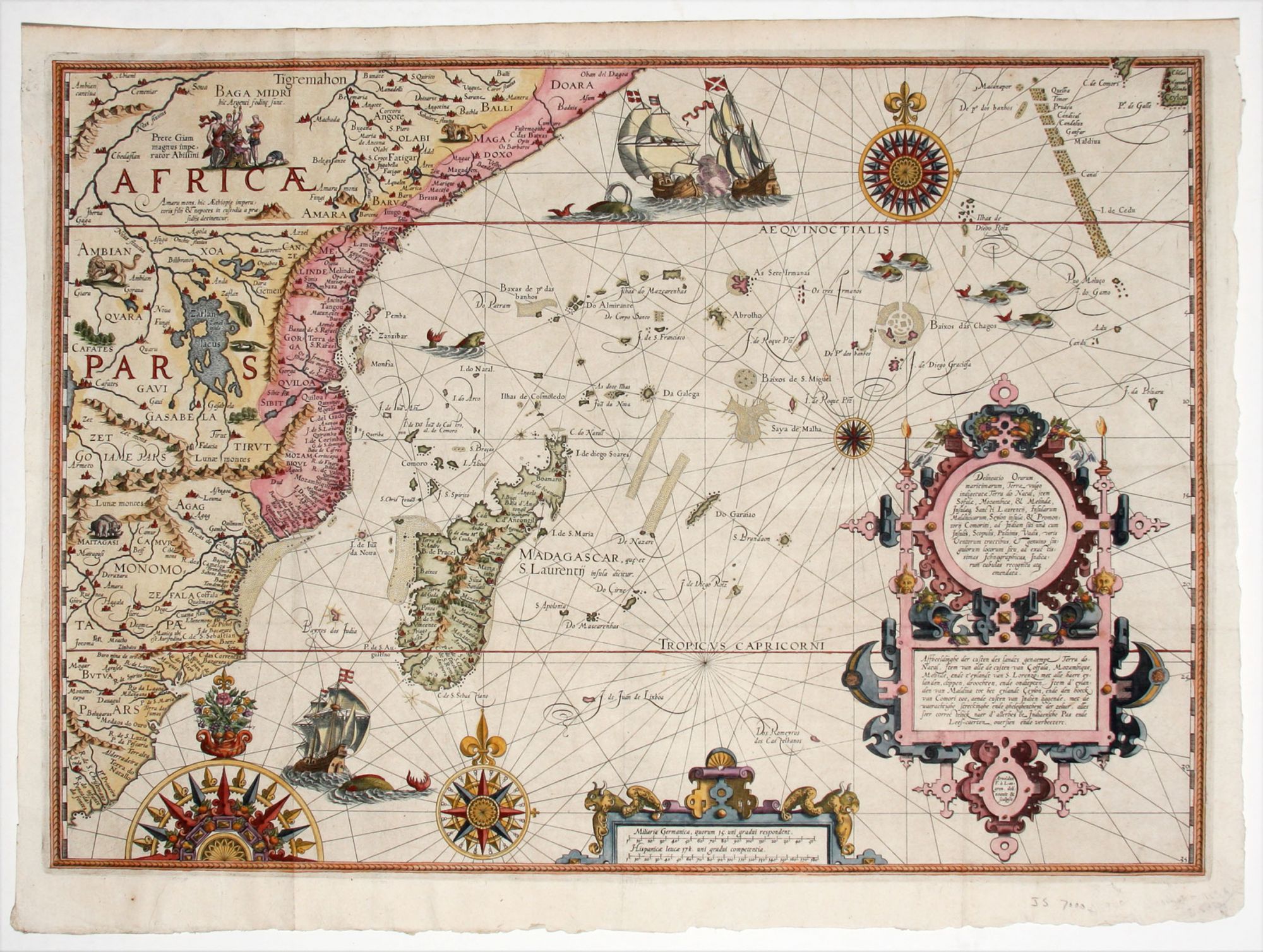
Delineatio Orarum maritimarum.
15 1/8 x 20 3/8 inches. Fine hand color; excellent condition.
One of the most richly engraved maps of early cartography in a richly colored example. Tooley described it as "the earliest and most decorative special map of the east coast of Africa embracing the eastern Cape, Natal, Portuguese East and Kenya." The map’s ornamentation, particularly the large, bold compasses roses and the dramatically heeling ships, is redolent of portolan charts. Not surprisingly then, Portuguese nautical charts, some undoubtedly portolans, were the chief sources of Linschoten’s maps. This map’s decoration also includes a school of whales and a vignette of Prestyr John, the mythical Christian king.
Jan van Linschoten (1563-1611), though of Dutch origin, was secretary to the Portuguese Archbishop at Goa. In this capacity, Linschoten had access to numerous documents, including maps and sailing directions concerning the lucrative spice trade in the East Indies. Upon his return to Holland, Linschoten published this material in his Itinerario, arguably one of the most influential books ever published in that it gave access to the spice trade to, first, Holland and then other to other European nations, as editions of the work proliferated.
* Tooley MCCS No. 29, 168; Norwich 239b; Tooley et al, Landmarks of Mapmaking (illus.) pp. 168-169.
Sold