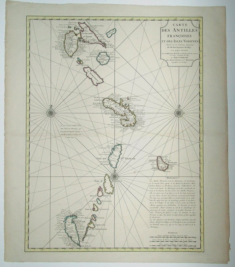
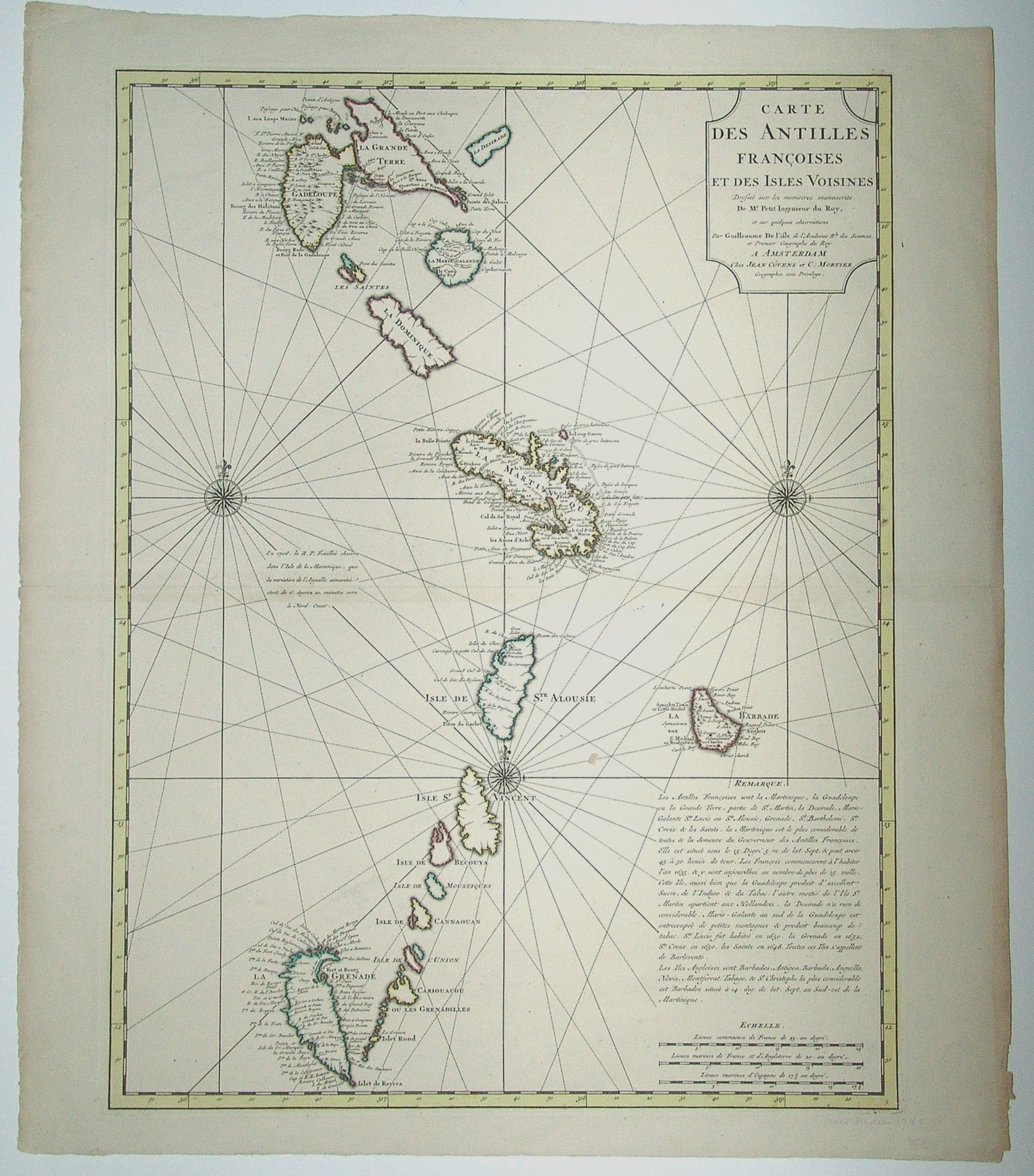
Caribbean/ French Antilles/ Grenada.
[Amsterdam, 1717/ 1730]
Carte des Antilles Francoises et des Isles Voisines.
23 ½ x 17 ¾ inches. Original outline color; excellent condition.
A very handsome example of De l’Isle’s map of the French Antilles, covering an area stretching from Guadeloupe in the north to Grenada in the south. This is the Amsterdam edition of the map, printed by Covens & Mortier.
Sold
See all items in
Antique Maps
See all items by DE L’ISLE G. / COVENS, MORTIER