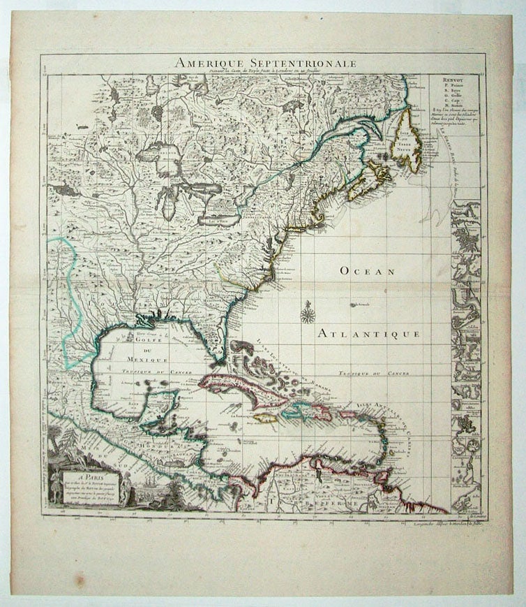
Colonial North America.
[Paris, 1742]
Amerique Septentrionale Suivant la Carte de Pople.
20 x 18 1/2 inches, Original outline color; excellent.
A handsome key sheet from a French edition of the first large-scale map of colonial North America. Among the 18 inset maps along the right border are ones of Bermuda, Boston, New York City, and Charleston. Popple's original, 1733 map ran to 20 sheets, hence the necessity of a key sheet. It was a semi-official undertaking intended to depict for British colonial administrators the respective North American territories of England, France and Spain. This French-published version, as expected, greatly exaggerates French territory at the expense of both England and Spain.
* cf. Schwartz/ Ehrenberg, pp. 151-52.
Sold
See all items in
Antique Maps
See all items by H./ LE ROUGE POPPLE, G.