
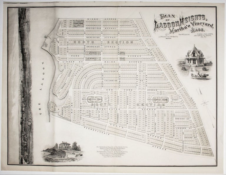
Plan of Lagoon Heights, Martha’s Vineyard, Mass.
25 ¾ x 34 inches, Two-stone lithograph. Fine condition, especially for its type.
Very much in the category of something much better than it needed to be is this promotional map with three superb vignettes of the “Lagoon Heights” development in the area of present-day Oak Bluffs on Martha’s Vineyard. In addition to two charming images Victorian summer homes, the wonderful seascape along the left margin affords potential buyers with a glimpse of the view they would enjoy from Lagoon Heights, with a salt meadow in the foreground and Oak Bluffs harbor in the distance. The result is one of most artistically realized promotional maps we have seen.
By the 1870s a thriving commercial town in Oak Bluffs began to develop in the area where Methodists and Baptists had gathered for summer meetings beginning several decades earlier. Lagoon Heights, an elevated area on the west side of the headland, facing a sheltered lagoon and with sweeping views Vineyard Sound, was part of the transformation of the area to a more secular vacation grounds. However, despite the careful planning of the development as evidenced by this work, it was derailed by the Panic of 1873, the year the map was published, that ushered in a long depression.
* Rumsey #5306.
Price: $950.00