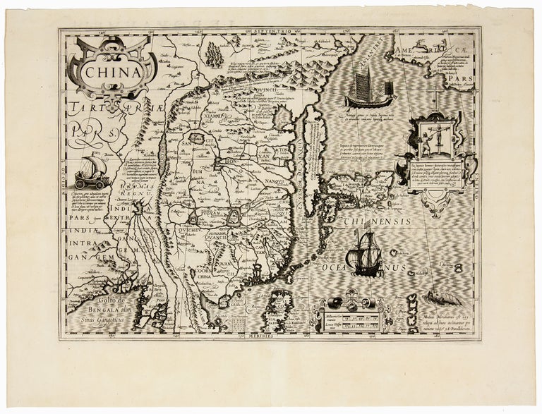
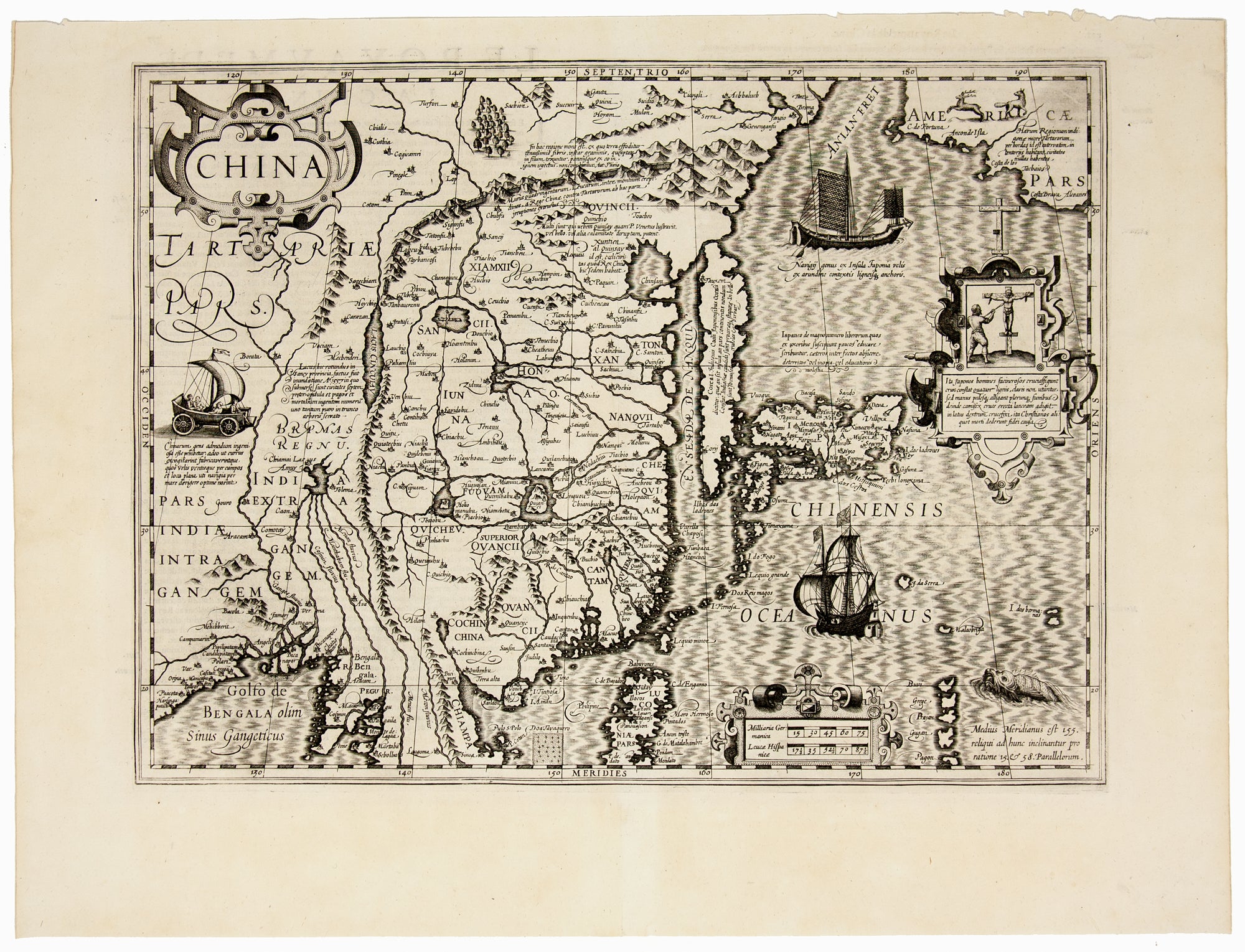
China.
Double-page engraved map, measuring 34.5 x 46 cm, with large margins. Inset depicting crucifixion of a Christian missionary. The map is decorated with 2 ships, a sea creature, a sailboat with wheels, and American animals. French text on verso. Upper right corner dogeared, not affecting the image. Otherwise, excellent, inked black and white impression. One of the earliest maps of China, depicting insular Korea, Japan, the Philippines, and the Great Wall in the north. The northwest coast of America can be found in the northeast corner of the map, separated from the Asian continent by the semi-mythical Strait of Anian. The map comes from a French edition of the Mercator-Hondius-Janssonius atlases. The maps from these atlases are notoriously hard to date and have been deemed “a bibliographer’s nightmare” by Peter Van der Krogt. Initiated by Gerard Mercator (1512-1594), the first atlas of these maps was completed by his son, Rumold Mercator in 1595 and had 107 maps. In 1604, the copper plates of Mercator’s Atlas were bought by the Amsterdam-based printer Jodocus Hondius (1563-1612), who augmented the atlas and published several editions of the maps, including the first French-language edition of the atlas in 1609. In 1633, Jodocus’s son Henricus Hondius (1597-1651) and his brother-in-law Joannes Janssonius (1588-1664) published another, French-language edition of the atlas with 239 maps. In 1639, they produced another French-language edition with 320 maps. The map includes large illustrations of both eastern and western-style ships. Of particular interest is the vignette depicting the Japanese method of capital punishment by crucifixion. It is most likely that the victim represented here is a Portuguese Jesuit. Shortly before this map was published, there was a virulent reaction by the Japanese against, mainly, Portuguese Jesuits, who were felt to be amassing too much political power. Dutch and English merchants were the chief rivals of the Portuguese for trade within Japan, thus such a vignette on a Dutch map would not have been the occasion for an outpouring of grief. The text on the verso of the map contains rich ethnographical information including on Chinese porcelain, clothing, and many other curious topics. *Van der Krogt, “Amsterdam Atlas Production in the 1630s: A Bibliographer's Nightmare,” Imago Mundi 48 (1996), pp. 149-160; Koeman/van der Krogt 8410:1:111 (1609 French): 137.
Price: $3,850.00