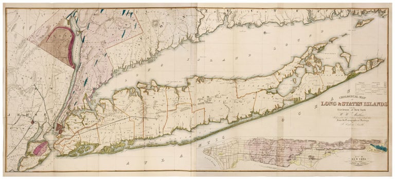
Geological Map of Long & Staten Islands with the Environs of New York….
22 x 50 inches. Fine, full original wash color; folds as issued, lightly toned in few areas, fine overall. A large, very well-detailed map of Long Island that highlights the area's geological and topographic features and indicates in yellow coloring the beach areas existing at the time. The Connecticut shoreline and Manhattan and its surroundings are also included. A large inset of Manhattan in the lower right depicts its topography in detail. Roads and the locations of homes are shown throughout Long Island as is a partially completed Long Island Railroad. The map reveals how sparsely settled most of the island was at the time. The map appeared in Mather’s Geology of New York, Part I. Mather was Professor of Natural History at Ohio University and served as Geologist of the First Geological District of New York for Governor William H. Seward. Smith was a surveyor who in 1860 would produce a mammoth wall map of New York State.
Price: $3,500.00