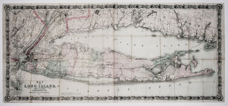
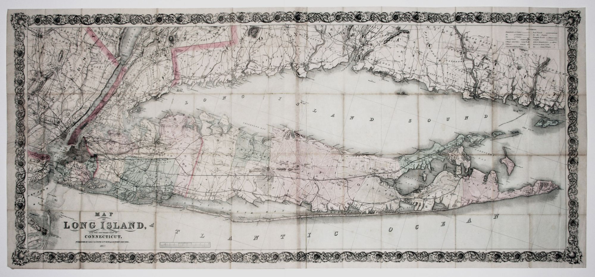
Rare, Large, Highly Detailed Map of Long Island Sound & Vicinity
Long Island/ Connecticut.
COLTON, G. W. & C. B.
[New York, G. W. & C. B. Colton, 1872]
Map of Long Island, and the Southern Part of Connecticut.
Two sheets joined together to make one map. 57.7 x 130 cm (27.7 x 51.1 inches). Lithograph with original hand color. Slight wear at a few fold intersections & a few stains, else excellent condition.
A scarce, separately published map of Long Island Sound and its surrounding shorelines. Counties are shown in different colors and containing an up-to-date depiction of railroads and major roads. The latter are also provided along the Connecticut shoreline. Also shown are canals, "Mills & Manufacturies," churches and meeting houses. The locations of private homes and some street grids are depicted in Long Island, reflecting the area's growing population. The place name, "Fire Islands," refers on this map to three small islands within the long barrier island, part of which is now called Fire Island. Though J. H. Colton had earlier printed a map under the same title, the present work was entirely re-engraved and updated.
Rumsey (5073) lists only the 1863 edition.
*Rumsey 5073.
Price:
$6,500.00