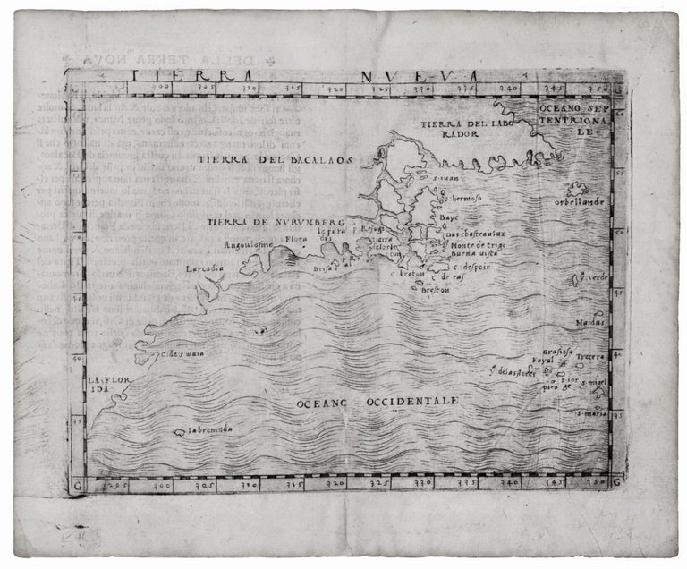
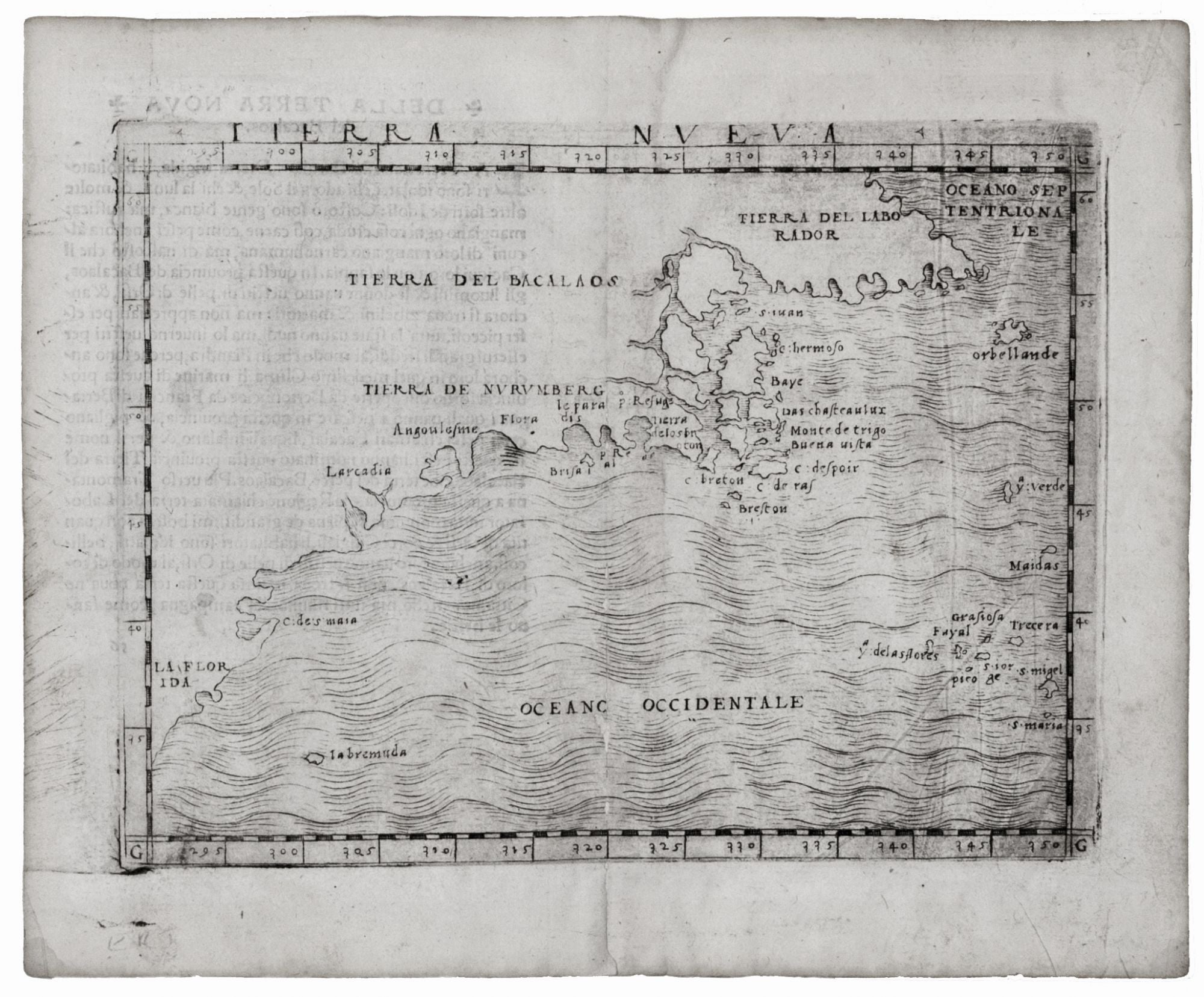
Tierra Nueva.
5 1/4 x 6 3/4 inches. Some wear at centerfold with very negligible loss, very good. Very scarce—one issue only of this very early engraving. This is earliest collectible map of the eastern seaboard and the earliest to provide a representation of the New York City area. It is also the first map listed in Palmer's "Chronological List of Maps & Charts [of Bermuda]" and is thus the earliest obtainable map with Bermuda (here "labremuda") on it. The map appeared in the first edition of Ptolemy’s Geographia that included regional maps of the Americas (see Burden 21).
Based on Verrazano’s explorations, the map’s double-bay configuration of New York Harbor (near the place name “Angoulesme”) is clearly recognizable though directionally misaligned; it even includes a river entering the Upper Bay. Curiously, this map does not include the famous Sea of Verrazano that was adopted by Munster and other mapmakers of the mid-16th century. This is perhaps testimony to Gastaldi’s judicious handling of his source material. The northern area embodies knowledge gained from Cartier’s first voyage to the Gulf of St. Lawrence. The general names given here for North America are the familiar “Tierra Del Bacalaos” (Land of Cod) and the less familiar “Tierra De Nurumberg,” likely a variant of Norumbega.
This is the sole issue of the map by Gastaldi; it was followed by a re-engraved edition in a slightly larger size, usually catalogued under Ruscelli, of which there were four successive issues. Gastaldi’s edition of Ptolemy’s atlas was significant for being the first small-format, portable iteration of that work. It was also the first atlas since the beginning of the 16th century whose maps were copperplate-engraved, thus re-introducing a technology that would be used almost exclusively in the printing of maps until well into the 19th century.
Burden 16; Palmer, M. Mapping of Bermuda, A Bibliography of Printed Maps & Charts 1548-1970, pp. 4, 14; McCorkle 548.1.
Price: $7,850.00