
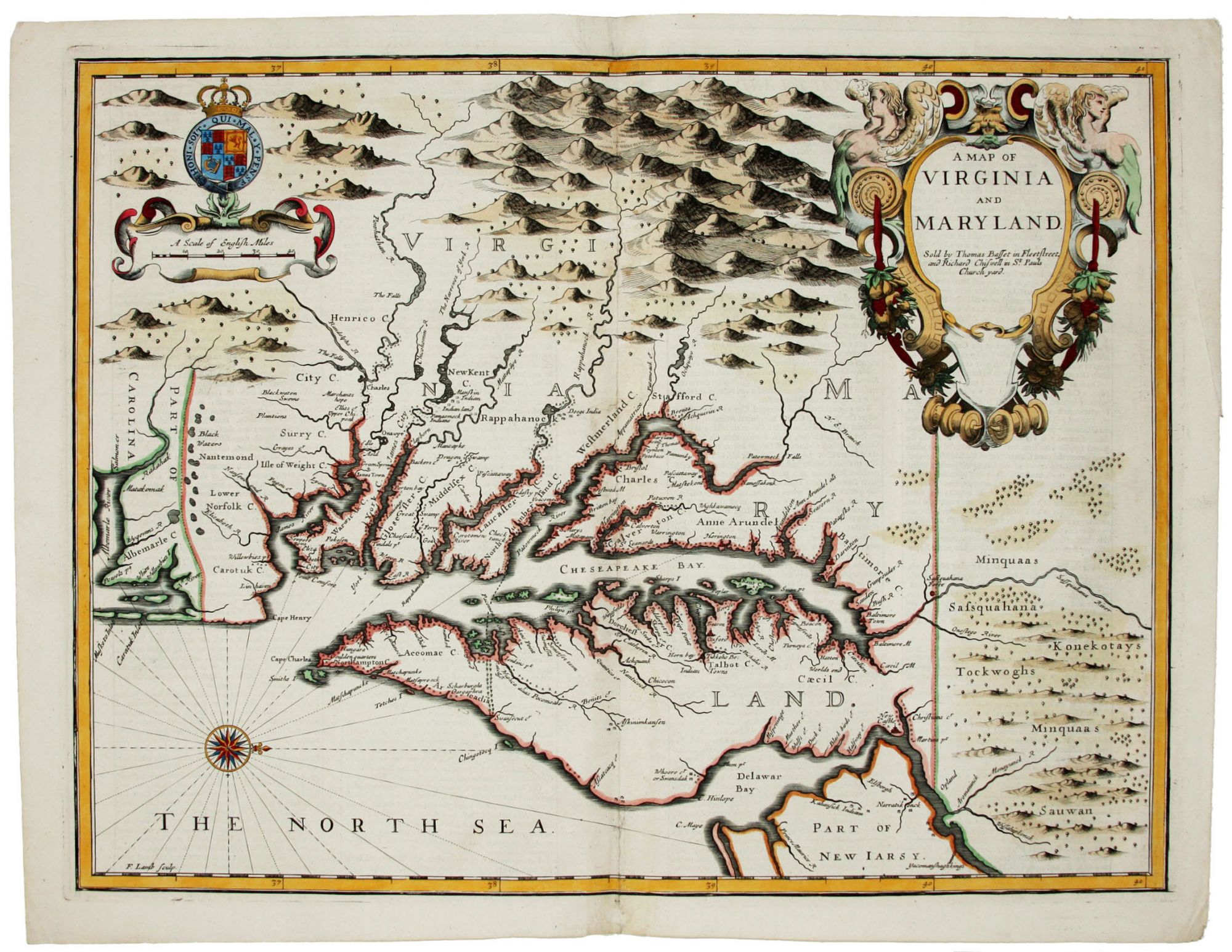
A Map of Virginia and Maryland.
14 3/4 x 19 ¼ inches, Fine hand color; wear to bottom of centerfold, else fine condition.
A very attractive, near-mint example. Speed's handsomely engraved work is one of the earliest English maps of the area and one of the first to demarcate the borders of colonial Virginia and Maryland. Just three years before the publication of Speed’s map, Augustine Herrman had conducted the first thorough surveys of Maryland at the behest of Lord Baltimore. Speed’s was one of the first maps to adopt this groundbreaking cartography. However, in general outline Speed still followed the prototype of Captain John Smith, who conducted the first European survey of Chesapeake Bay. Speed's map "is the last major derivative of the Smith map, and it is unique as an example of the transition from one basic prototype map to another. The delineation of the land area follows Smith while the toponymic prototype was the Herrman map of 1673." (Verner in Tooley, Mapping of America, p.170) A particularly important feature derived from Herrman by Speed is the boundary line (indicated by a double row of trees) between Virginia and Maryland on the Eastern Shore. English text on the verso contains extensive descriptions of Virginia and Maryland.
* On the Map, fig. 11; Stephenson & McKee, p. 39. Burden 456, state 1.
Price: $6,500.00