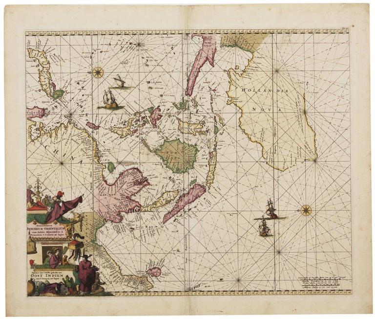
Orientaliora Indiarum Orientalium cum Insulis Adjacentibus… / Pascaert van t’Ooster gedeelte van Oost Indien.
17 ¼ x 21 ¼ inches. Fine original color; fine condition.
Superb original-color example of the Renard edition of one of the most beautiful 17th-century charts of the area. Schilder described the maps of the De Wit firm as being "distinguished by their excellent craftsmanship, exactness and beauty." Romeyn de Hooghe’s intricately etched cartouche shows a European trader accompanied by a servant conversing with the silk-bedecked, fan-bearing denizens of the pagoda that gives the cartouche its shape. The scene is populated with many native figures, parrots, a monkey, and what appears to be a small dragon. The map has been praised as one of the finest of those with a post-Tasman depictions of Australia. It appeared in De Wit’s 1675 Atlas de la Navigation, one of the most striking products of Dutch maritime cartography, and reappeared in 1715 in Renard's Atlas de la Navigation.
* Tooley Australia, The Mapping of Australia, p. 206, no. 41; Schilder, G. Australia Unveiled, p. 406; Clancy, R. The Mapping of Terra Australis, p. 83
Price: $4,850.00