
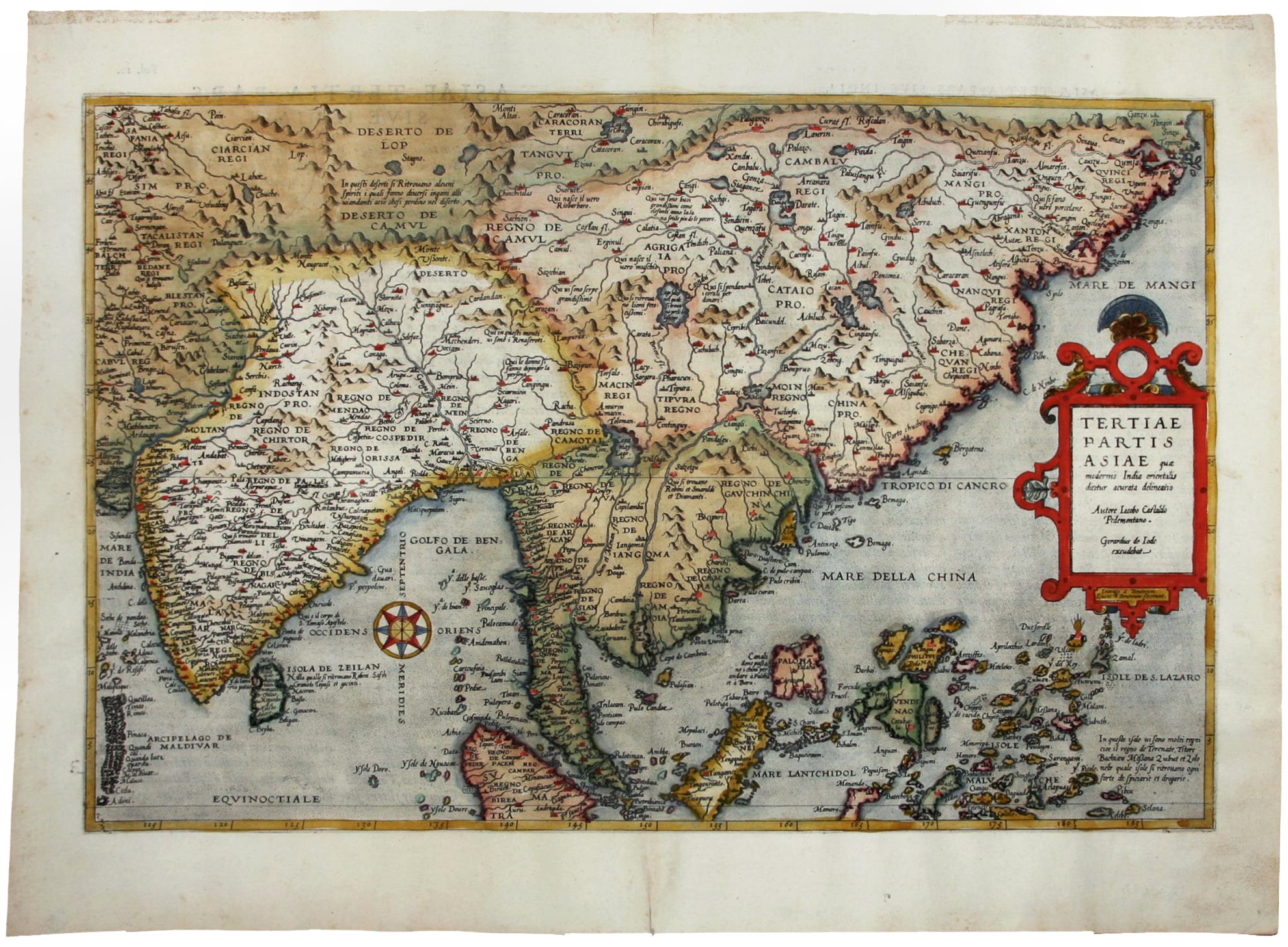
Tertiae Partis Asiae….
13 x 19 ¾ inches (33 x 50.1 cm). With text in Latin on verso. Fine hand color; fine condition.
A superb example of an early map of eastern Asia that includes all of India, most of China, Indochina, the Philippines, and the Malay Peninsula including Singapore, which is here called “Cingatola.” Characteristic of the earliest European maps of the area, the coast of China is a relatively straight, diagonal line. A more accurate general outline of China would have to await the more careful, Sino-Jesuit surveys that would be conducted in the first decades of the 17th century. India’s general shape, however, is drawn with considerable accuracy. De Jode based this map on the surveys of Portuguese missionaries, as transmitted by the Italian mapmaker, Gastaldi, in his five-sheet map of Asia of 1561.
The De Jode family (Gerardus, the father, and Cornelis, the son) had the misfortune of entering the atlas market at the same time as the formidable and well-connected Abraham Ortelius. Although the De Jodes were arguably the equals of their rival as mapmakers, they were no commercial match for Ortelius. They published a mere two editions of their atlas as opposed to approximately 40 by Ortelius. Hence, the considerable rarity of De Jode maps in today’s market.
Price: $8,500.00