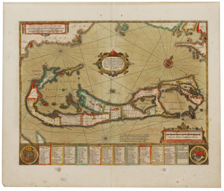
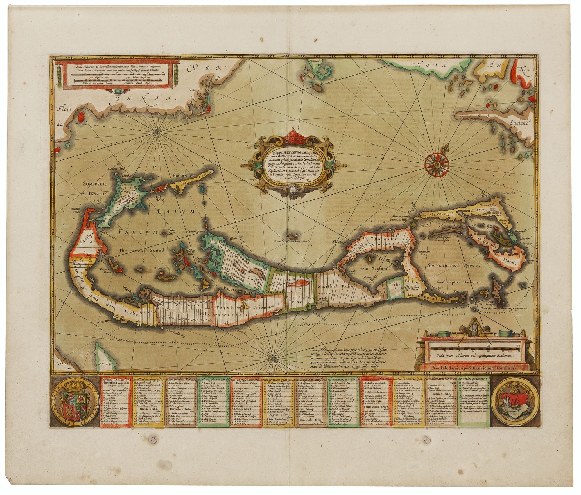
Mappa Aestivarum Insularum, alias Barmudas.
15 1/2 x 20 1/4 inches. Fine contemporary color; lightly toned, else excellent condition. First atlas issue, in warm contemporary color of this classic Dutch map of Bermuda. As were most 17th century maps of Bermuda, Hondius’ was based on Richard Norwood’s 1618 chart, executed on behalf of the Bermuda Company. The map thus includes the parishes and tribes allotted to the company’s principal members with their names included, most of which survive in one form or another to this day. The map vividly illustrates how hazardous the coastline of Bermuda was and is to shipping by the almost unbroken ring of crosses signifying reefs surrounding the island. At lower left are the Royal Arms of Great Britain and at the lower right the arms of Bermuda depicting the grounding of the Sea Venture of the Virginia Company in 1609, which resulted in Bermuda’s first settlement and in Shakespeare’s Tempest as well. The engraving actually includes two maps of Bermuda of different scales. Nestled within the hook of the island is another, smaller depiction of Bermuda, placed there to show its position and size relative to Cape Cod, Nova Scotia and Virginia. (Roanoke, Cape Henry and Cape Charles are all named). This design proved confusing to some later copiers, who dispensed with the mainland in their renditions while mistakenly retaining the smaller “Bermuda,” thereby transforming it into a small island off the coast of Bermuda.
* Palmer, MCS No. 19, map no. 8; van der Krogt 9660:1:401.
Price: $4,500.00