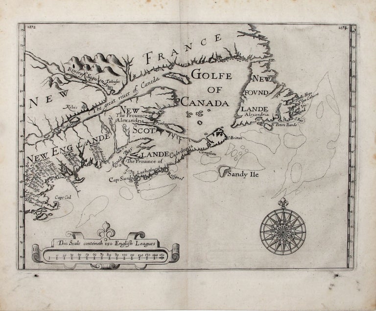
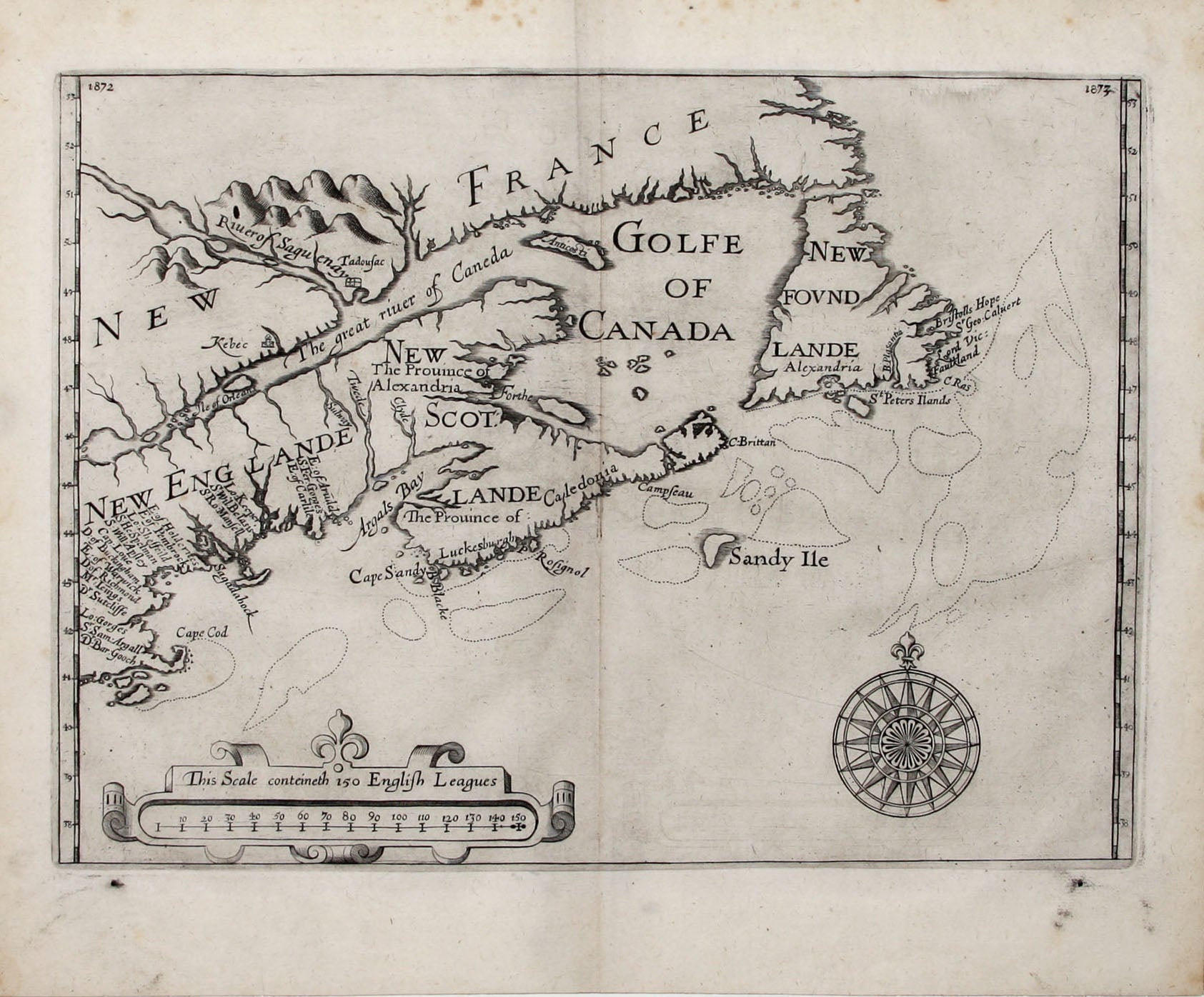
Untitled Map of New England and Canada.
9 7/8 x 13 5/8 inches. Fine condition with a dark impression. A mint example of a “map of great importance” (Burden). This is the first and only cartographic document reflecting an early plan for the colonization of northern New England by Sir William Alexander and the earliest printed map with the place name Cape Cod as well as the first to name Nova Scotia, here called New Scotlande. The map "locates twenty patentees among whom the region extending from Cape Cod to Maine was divided by the Council for New England in 1623" (Schwartz). These patents were granted by James I and Charles I to members of English nobility. The design for this colonization project was envisioned by Alexander to create “large English manors or estates that would be independently governed by English lords” (Krieger/ Cobb), but the plan never came to fruition, reflecting a lack of a coherent policy for its development back in England and sufficient funds to support it. Alexander’s map first appeared in 1625 in a very rare promotional pamphlet entitled Encouragement to Colonies which failed to sell his colonizing concept, given the prospect of New England’s harsh winters and other hardships, to potential English buyers – this despite the lure of the rich fishing grounds the north Atlantic provided along its coast. As a result, Alexander lost a fortune, but his map was important. As a piece of English cartography for this part of North America, it was one of the best of its time and soon appeared in Samuel Purchas’ multi-volume work Purchas His Pilgrims along with Briggs influential map of the continent. Together, they claimed for English mapmaking an authoritative knowledge of the internal geography of a largely unknown part of the world rivaled by few other maps of the period. The Purchas edition of the Alexander map can be distinguished from the earlier pamphlet edition published the same year by the presence on the Purchas of page numbers in the upper corners; otherwise the two editions are identical.
* Cobb/ Krieger, Mapping Boston, pl. 8, p. 85; Burden 208; Schwartz/Ehrenberg, Mapping of America, pp. 99, 102, pl. 54; McCorkle 624.2; Cumming et al, Discovery of North America, pp. 269-270, pl. 334; Kershaw, K. Early Printed Maps of Canada, pp. 84-5.
Price: $14,750.00