
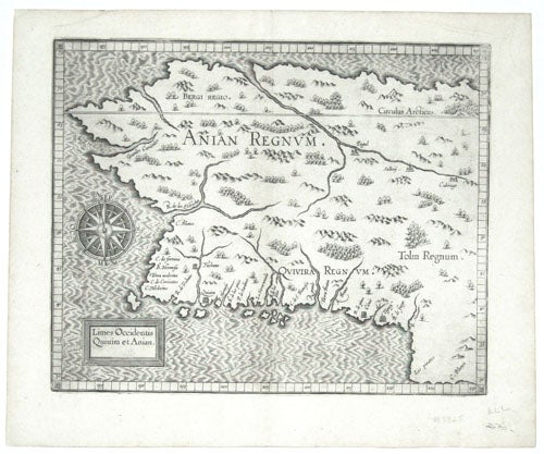
California/ Northwest/ Alaska.
[Louvain, 1597]
Limes Occidentis Quivira et Anian. 1597.
9 1/4 x 11 1/2 inches. Fine condition.
"In many respects this map is the first printed map of Alaska." (Verner) However, much of what is shown here is imaginary, since most of the area covered by the map had not yet been seen by Europeans. The map does extend to northern California, so in its southern portions there is some correspondence to reality. It must be remembered that even the question of whether a strait existed between northern America and Asia (though one is clearly shown here) was still two centuries away from being answered.
* C. Verner, The North Part of America, p. 84.
Sold
See all items in
Antique Maps
See all items by C. WYTFLIET