Kurtzgefasste Geographie zum Gebrauch der Trivial-Schulen, nebst einem Alphabetischen Verzeichnisse der merckwürdigsten Oeter des bewohnten Erdbodens.
8vo [17.6 x 10.2 cm], (2) ff. (map and title page), 2-5 ff., (1) f., (1) p., 16-96 pp., (11) ff., (1) f. integral blank, with the full-page 2-hemisphere engraved world map in contemporary hand-color, and with figural woodcut headpieces, initials and tailpieces. Bound in contemporary sprinkled pasteboards, paper label laid to spine, red sprinkled edges, shelf-mark in red pencil on upper cover. Some rubbing and edge wear to spine and boards. Occasional minor browning, a few contemporary annotations in the text.
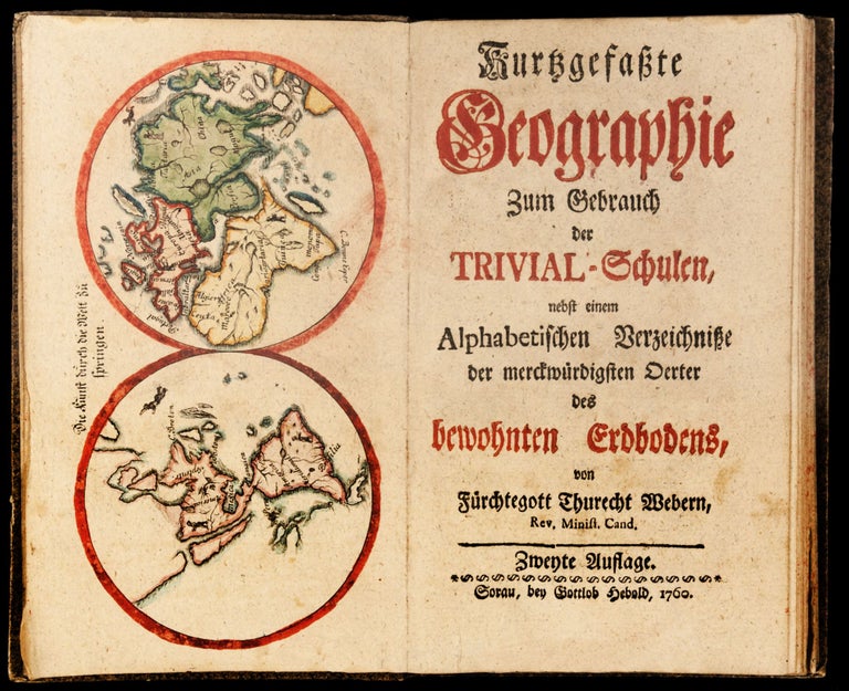
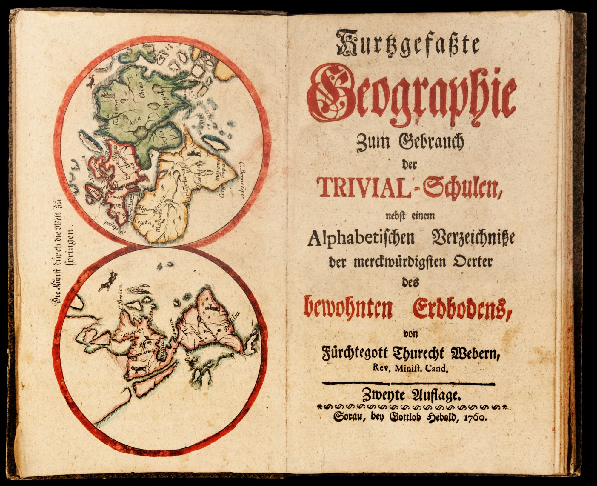
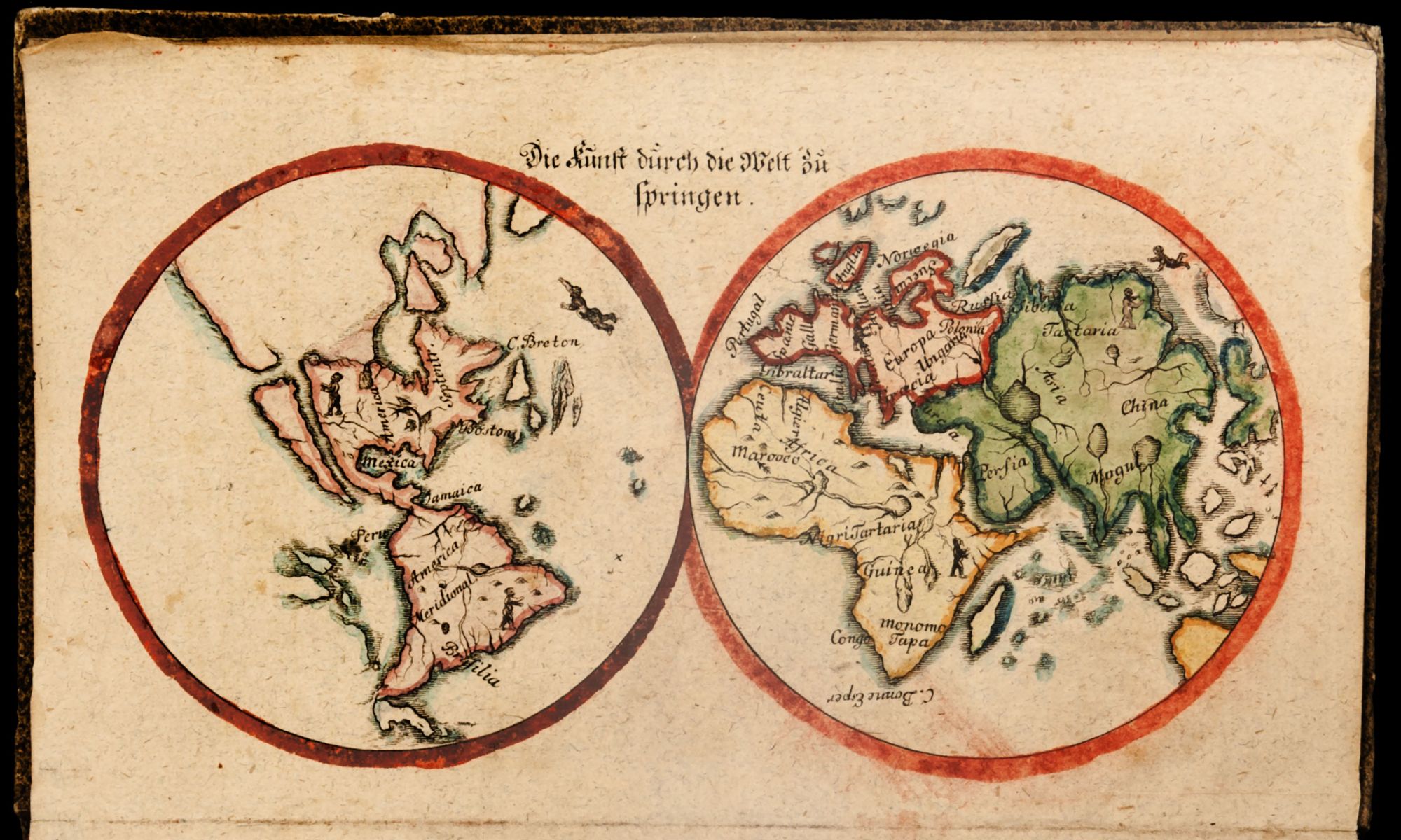
Very rare second edition of an 18th-century geography primer for German elementary school children written by the minister Fürchtegott Thurecht Weber (1722-86). The Kurtzgefasste Geographie zum Gebrauch der Trivial-Schulen is illustrated with a charming two-hemisphere world map in contemporary hand-color entitled “The art of jumping across the world,” which shows young children hopping from continent to continent: One child prepares for a leap from North America to California, which here is depicted as an island.
After a short apologia extolling the virtues of building for children a firm foundation in geography, Weber first orients his young readers by introducing basic facts about each of the four continents of Europe, Asia, Africa, and America, including information on dimensions, bodies of water, population data, demographics of religion, and languages. His second part treats the individual nations (apart from Germany), discussing location or position relative to Germany, borders, political organization, regions, notable cities and towns, terrain, and information on weather and the dispositions of inhabitants. An entry on North America, for example, notes that the principal cities are “S. Augustino, S. Louis, Carolina, Charles-Town, Savannah, James-Town, Filadelphia, Boston, Port Royal, or Annapolis, Qvebeck … Florida belongs partly to the Spanish, French, and English, partly it has its own kings” (p. 52). Part three is devoted to Germany, and, dealing as it does with an area of the world more accessible to its young readership, is more extensive and detailed than previous sections; here are found several annotations and amendments made apparently not by children but by a teacher. Appended to the main text is an alphabetical index of more than 600 notable cities and the country or German territory where they are located
Perhaps owing to the daily wear it would have suffered as a schoolbook, the Kurtzgefasste Geographie zum Gebrauch der Trivial-Schulen is now a very rare title, with OCLC and KVK locating only 2 global copies, both in Germany (Universitätsbibliothek Augburg and Universitätsbibliothek Göttingen); curiously, the Göttingen example is a different issue than the book offered here, being entirely reset, without the woodcut headpieces, tailpieces, and initials and with a re-engraved copy of the world map. Weber’s work first appeared in a deluxe folio edition in 1754 under the title Geographie zum Gebrauch der Schreiberischen Land-Charten mit und onhne dieselben, and this version, found only at the Universitätsbibliothek Göttingen, is also of great rarity.
* VD18 90218161; F. A. Weiz, Das gelehrte Sachsen, p. 265.
Sold