
Transylvania/Romania..
[Basel, 1552]
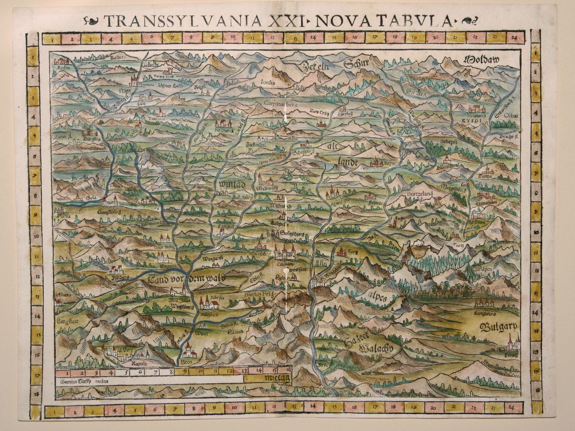
Transsylvania XXI Nova Tabula.
11 ½ x 14 ¾ inches. Fine hand color; mended wormholes along centerfold, very good condition.
This attractive and detailed woodcut is the earliest acquirable printed map specifically of Transylvania. It is derived from Honter’s 1530 Chorographia Transylvaniae Sevémbürgen, which was the first modern map of the region. This example is from the rare 1552 edition of Munster’s Geographia, the only one to feature coordinate bars provided at top and bottom.
Sold
See all items in
Antique Maps
See all items by S. MUNSTER