
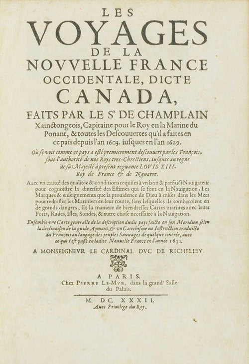
Les Voyages de la Nouvelle France occidentale, dicte Canada…depuis l’an 1603 iusques en l’an 1629.
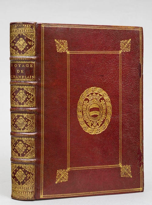
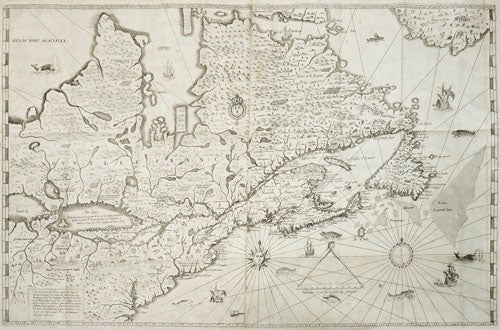
4to. [24.8 x 17.2 cm], 1 vol. in three parts: 16, 308, 310 pp.; 1 blank; 8, 54, 1 blank; 20 pp. and one large folding map on two sheets (560 x 875), including 6 engravings in the text, of which two are full-page. Bound in lavishly gilt 17th century red morocco, with the slightly later addition of the arms of Charles-Henri Comte d’Hoyme (1694-1736), plenipotentiary of August II, elector of Saxony and King of Poland, to the French court (Olivier 672.1). Some inconsequential spotting; expert repair to map without loss; minor repair to front cover slightly affecting gilding. A magnificent copy.
First collected edition of this landmark of discovery Americana, augmented with new material and, above all, the first appearance of Champlain’s seminal two-sheet map of the Great Lakes. This copy comes in the rare first issue of both text and map, in a splendid contemporary red morocco binding with the arms of Comte D’Hoyme stamped in gold.
“Champlain’s majestic account of his life’s work, the Voyages de la Nouvelle France (1632) constitutes the principal source for these early decades. In the context of a year by year narrative, Champlain highlights the colonial potential of New France. He identifies its agricultural and natural resources and provides useful information about Amerindian cultures” (Les Nouvelles Frances, JCB Cat., p. 24).
Considered the most complete edition, this is the last edition to be published in Champlain’s lifetime, and its second and third parts augment Champlain’s previous works with a ninth voyage undertaken by Champlain, bringing the history of Canada up to date; further, it contains a treatise on navigation and two pastoral works, both in Algonquin/French. This copy contains the first state of the leaves supposedly offensive to Cardinal Richelieu (a joke about rulers of state making lousy sailors), found corrected in a majority of copies. Finally, the map is in the rare first state, showing the east side of the Grand Banks before alterations and showing Cape Breton with an inland lake rather than a mountain range. Burden notes that the map is “very rare… and could be labeled the first to depict the existence of the entire Great Lakes network” (Mapping of America, no. 237).
Provenance: A wealthy nobleman and Polish ambassador to France, Comte d’Hoyme began collecting books in 1715; his sale in 1738 (including the present work, no. 3262) fetched 85,000 livres. Building his collection at the most important sales of his day (those of du Fay, Jean Baptiste Colbert, and Michel Brochard), d’Hoyme sought only the finest morocco bindings, or had them made himself with specially-sourced skins from Turkey. D’Hoyme bindings are eagerly sought after by collectors.
* Church 420; Lande 118 (incomplete); JCB 3.II.239; Harrisse, Nouvelle France, 51; Pilling, Algonquin, 79; Field 268; Burden, The Mapping of North America, 237; Jerôme Pichon, Vie de Charles-Henry, Comte de Hoyme, Ambassadeur de Saxe-Pologne en France: et Célèbre Amateur des Livres; Catalogus librorum bibliothecae illustrissimi viri Caroli Henrici Comitis de Hoym, no. 3262 (Paris, Martin, 1738).
Price: $0.00