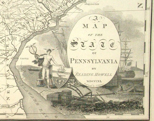
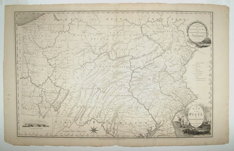
Pennsylvania.
[Philadelphia, 1811]
A Map Of The State Of Pennsylvania By Reading Howell MDCCCXI.
21 3/8 x 33 ½ inches. Deckled edges; centerfold reinforced, else excellent.
Separately published—very scarce. In 1792 Reading Howell published the first map of Pennsylvania to show the full extent of the state with accurate boundary lines. The present work is an amplified version of this work and the first edition of it published in the 19th century. Moreover, this edition was elegantly engraved by John Vallance, who also produced the first official plan of Washington, DC and the Griffith map of Maryland. Howell’s excellent map was not superseded until 1822 when Melish’s map of the state appeared.
* Ristow, pp. 108-109; cf. Rumsey 4181.
Sold
See all items in
Antique Maps
See all items by R./ VALLANCE HOWELL, J.